Wasatch Mountains: Monte Cristo area

Mt. McKinnon, Wasatch Mountains

This past summer I took a little drive on my day off. Since I’m always in the Uinta Mountains (it seems), I decided to head up to the Wasatch Mountains this time. And I took all 4 dogs. Since Miss Moose isn’t up for big adventures, we did some short walks and a lot of poking around. I decided on Monte Cristo because I’m always up for food-named places and I heard it was beautiful. It’s northeast of Ogden and it’s usually a good 10-20 degrees colder than the valley. I headed up UT39 and took the dogs for a short run/walk on an ATV trail to get some energy out because enthusiasm levels were high, as you can see in the images below. Disclaimer: my dogs are leashed any time I intend to encounter another person. This was not that place, plus it was 7 am so you can see Reina is roaming.

The views driving on UT39 are gorgeous. You can overlook the Ogden Valley and get some amazingly beautiful views. Not many pictures, though, as there aren’t a ton of places to stop and I was driving so no “ shoot out the window and hope it turns out” shots. I did find a nice pull off to experience the beautiful summer mountain flowers. I think those blue flowers below are a type of bellflower. Pretty meadows also give way to mountain landscapes. It’s definitely a great place for nature photography, if the valley inversions behave themselves. There was a bit of haze when I went out, but overall the view was pretty clear.

The girls had a lot of fun both poking around the hillsides and exploring. Dogs are welcome as it’s National Forest, just observe basic trail etiquette. Mt. McKinnon is the high point in the area, and again, the views are gorgeous. We ended up sitting on the side of the mountain for a little bit (Miss Moose mandated it) and just relaxing. We went on a weekday and it was fairly empty, though the campground fills up quickly in the summer.

We did a nice short morning excursion and we’re home in time to play with our foster kitten, Janika! (Gratuitous kitten picture below). Monte Cristo is absolutely gorgeous and only about 1-1.5 hours from downtown Salt Lake City, so perfect for a quick trip to get out of the heat or inversions. I haven’t attempted the route in winter yet, however and I believe part of the route on UT39 is actually closed once it snows.

The map below is pinned a little east beyond where I was on UT39. The National Forest is the green sector.

An interesting find in the Utah west desert

The Utah West Desert: perfect for social distancing.

Out on the border of the west desert in Utah, you’ll see some odd things: the salt flats, the Dugway bombing range scars, and strange plaques. This modified cairin and plaque in the Grassy Mountains were accessed by dirt bike; there are some nearby roads (primitive, “roads” is used loosely) on BLM land. This area is open for recreation: just on the west side of the Grassy Mountains is the Dugway proving grounds. Don’t wander into Dugway, aka Area 52 (as a former colleague and former Dugway employees tells me). This site used to be a test site for chemical weapons, though that was stopped years ago (check out the Dugway Sheep Incident for an incident involving Dugway in the 1960s).

The plaque in the Grassy Mountains.

Anyway, the plaque is definitely not anything official. It reads “This monument was made by Geo [George] Davis Bower in Dec 1895 herding sheep for Deseret Livestock Co plaque was made by Bower family put on Aug 15 1973.”

The map below shows the I-80 Grassy Mountains rest stop, the mountains directly north are the Grassy Mountains themselves. The marker is in the upper 1/3 of the mountains on the west side.

I was curious about this, so I sent an email to the Research Center of the Utah State Archives & Utah State History. The response was quick, and they’re very helpful and nice! They have no record of an official monument or plaque on the site, but they did find a young George Davis Bower on the 1880 census record for Croydon, Morgan, Utah (line 21 below). Also, there may be some evidence of polygamy in the census below. Three women heads of households with young children and the same last name (lines 9-18 below). This was in 1880, and Utah wasn’t granted statehood until early 1896 on the condition polygamy be outlawed. So, not illegal at this time, but still interesting. Utah’s late statehood was mainly due to the resistance to giving up polygamy.

They also sent me a bit of info on the Deseret Livestock Company, which was (and is) owned by the LDS Church. They had Mainly sheep, and now it seems another area owned by the same company is a bird refuge out in eastern Utah (according to the Audubon Society). The area out by this plaque was the Skull Valley Winter Range. The company wasn’t incorporated until 1891, so this monument must have been placed before it was “ officially “ a company. The Skull Valley Range was apparently purchased from the Iosepa Ranch in 1917 (so really this plaque may be off on dates or who actually owned the land when the monument was built). Iosepa is now a ghost town of a Hawaiian Mormon settlement. The town was actually deserted in 1917, when the Iosepa Ranch was also bought out. The area is really harsh, and it’s pretty easy to see why crops didn’t grow well before widespread irrigation was available. I have not been to Iosepa yet, and there’s not much of the buildings left. There is a monument and a cemetery that is still kept up by descendants, however.

For more information on the Deseret Livestock Company, I was sent this link to a digital book. If you happen to know anything about this area or monument/plaque please let me know! I’d love to learn more. Thanks for reading! I’ll update here if I learn any more.

Cliffs out in the west desert.

Haystack Lake in the Uintas

Uinta mountains
Flowered meadow (really a bog) up in the Uinta mountains.

I am really fortunate to live in a state that is encouraging people to go outside (safely) and that I can easily find places that are absolutely empty. Go a little ways off the paved road and you’re pretty much on your own (especially if you go on a weekday). We took the Monday after July 4th off and headed up into the Uinta mountains for some fresh air and cooler temperatures. The Mirror Lake Highway is fully open now, and I will again state my preference for the non-Kamas side of you want solitude.

With no real destination in mind, we decided to visit a couple alpine lakes. Apparently to be called an “alpine lake,” a body of water (reservoir or lake) needs to be located over 5000 feet. This was off of Mirror Lake Highway (FR041), there are quite a few little lakes you can hike to and visit. To be fair, the first “lake” — as it was denoted on forest service maps — was really a natural spring that made a bog-like meadow. I’m not complaining, it was beautiful!

Natural spring
Origin of natural spring in the Uintas

The stream from the spring meanders through the meadow/bog and there are quite a few wildflowers in bloom now. Yes, the water was COLD. I don’t think this spring/stream is named that I could find. There is a nice little primitive camping spot and fire ring (metal) in front of the meadow/bog (see first picture, that’s the camping spot, great view!). Didn’t see any animals here (aside from a frog) but saw lots of deer tracks.

Frog
Uinta Frog

The view is absolutely beautiful. We walked across the meadow/bog, it’s a bit squishy but not too bad.

Uinta Mountain Meadow

From the meadow/bog we continued up and visited Haystack Lake (with a view of Haystack Mountain). There are a TON of great camping spots along the east side of the lake. Some kind person has stacked firewood at them as well.

Haystack Lake
Haystack Lake

I saw a couple fish jumping, and supposedly the lake has Brook and Cuttroat Trout. Only 2 waterlilies were blooming (yellow ones).

There is a trail around the lake, or you can try to go along the shoreline (it gets pretty mucky). The west side has game trails going up the mountain too. We didn’t see any animals here, but heard something that may have been a moose. Or elk. Also saw moose tracks in the mud.

Haystack Lake origin

The only animal I saw was a chipmunk. Still pretty cute. Overall, a nice place for solitude, a little hike, and great scenery.

Utah Ghost Towns: Dividend to Silver City

It’s so easy to socially distance yourself in Utah, especially if you’re heading out to the West Desert. We did a little day trip around Eureka on Memorial Day. I heard the parks here were absolute zoos this past weekend, but (as usual) the ghost towns were empty. I think we saw a handful of people in Eureka (not a ghost town) and that was it. LOTS of people and campers headed to Little Sahara and Great Basin, but none stopped where we did. We headed south down Highway 68, which is bordered by farm fields (we saw at least 30 hawks and ospreys out hunting) and Utah Lake. Before we turned west onto Highway 6, I stopped to grab a shot of an old Sinclair station in Elberta, a town named for a peach.

Sinclair-wm-May-2020

Sinclair Station in Elberta, Utah on Highway 6.

It’s obviously abandoned (there was an old gas pump there until about 2013 or so) but well-maintained and there’s even a picnic bench behind it. And it’s much more picturesque than the equally abandoned Amoco across the street.

amoco-wm

Sorry, Amoco. You’re just not *quite* as cute as your Sinclair sister across the street.

Anyway, we started out by going to Dividend, which is home to the abandoned Tintic lead mine. Several years ago, before we moved out west, we explored the abandoned smelter and structures in the hills and were intending to go do that again. Well, (we did not know this until driving through) the mine and area has been on extreme lock down due to a very sad event in which two local teenagers were murdered and thrown in an abandoned mine shaft on the property (warning: the linked story is very disturbing). There is a nice (very large) memorial set up for the teens and most areas are now fenced off (and the mine shaft itself has been fenced). Some friends told us the property owner has security guards posted in the area, if you were thinking of ignoring the many posted “no trespassing” signs, FYI. The road through the area is still public and actually is a nice drive with some beautiful scenery, especially when you climb up the mountain. The event definitely puts a pall over the area, though. The only structure you can see easily from the road is part of an old bridge (below).

Dividend-wm-May-2020 - Copy

Tintic mine bridge ruins.

The area is also home to many sheep, and we saw a lot of lambs (they are really very cute, but as my husband reminds me they do not smell the best so I should not try to take one home). The sheep in the area are tagged with hearts, which is also very sweet. They were all freshly shorn and looked really well-cared for and happy. I mean, look at this sheep paradise!

dividend-sheep-wm

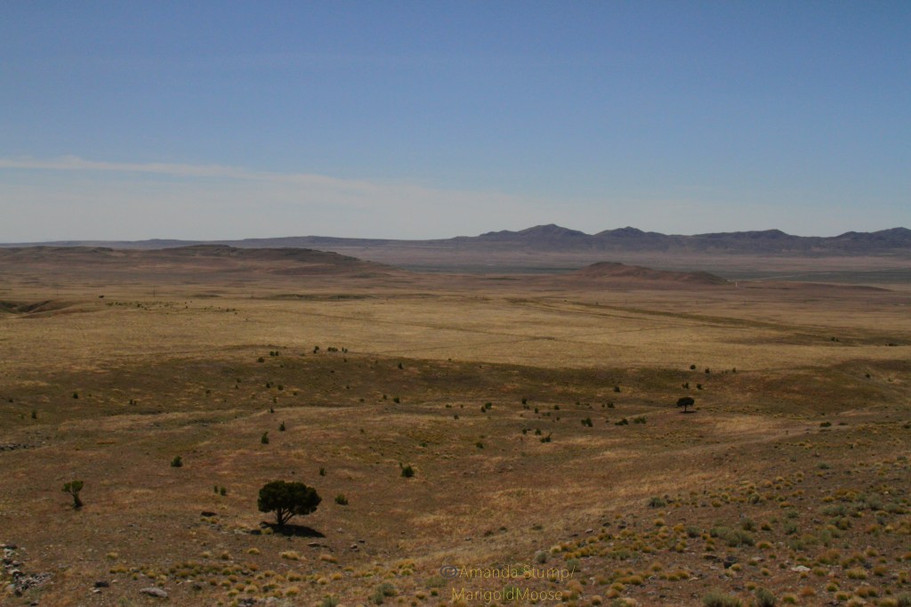
There are actually many sheep in this picture! Looking west.

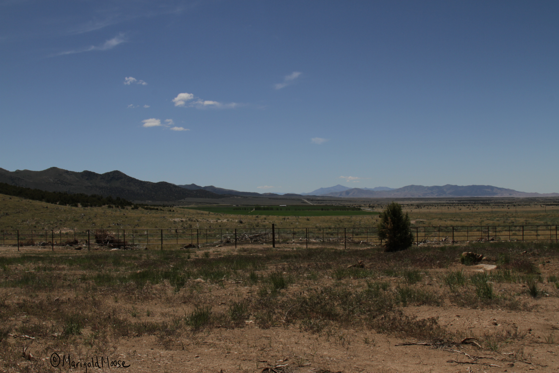
The area has some spectacular views of Lake Utah as well, it was a bit hazy when we went and I struggled with crystal clear pictures, so choose your days if you want better pictures than what I got.

utah-lk-wm

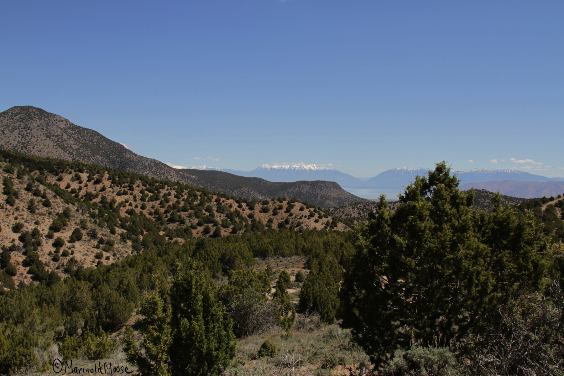
Lake Utah and the Wasatch Mountains beyond the Utah Valley.

utah-lak-wm

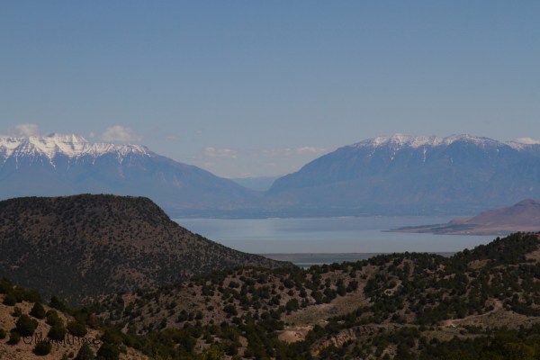
Lake Utah, which was actually much more green than captured here.

If you’re looking for mine ruins and want to skip the Dividend loop and the views above, continue on US 6 instead of turning off. The Dividend road will take you directly back to US 6 as well. Continue southwest on it and you will come to a little town called Eureka, home to about 800 people (and the hometown of the inventor of the Zamboni, Frank Zamboni). Sadly, there was no Zamboni that I saw or even a plaque. No wonder Utah doesn’t have an NHL team.

The remains of the Eagle and Bluebell mines are here, but are also clearly marked as no trespassing. There are actually a lot of structures you can see from outside, though.

mine-equip-wm

Eagle Bluebell mine buildings in Eureka.


If you head back down to Main Street/US 6 there is a little downtown area that has been kept up pretty well. The Gas Hole gas station is definitely of note.

gashole-wm

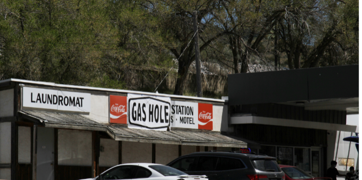
Please, please tell me they call gas stations this in Massachusetts.

You can visit the Porter Rockwell cabin. Porter was called the “Destroying Angel” and was the bodyguard of Brigham Young (and is probably one of the more interesting historical Mormons, he even brought the first brewery to Utah, a fact we’re still celebrating). The cabin was moved from its original location of Cherry Creek to downtown Eureka to preserve it. It has an interesting thatched roof and one of the creepiest stone signs I have ever seen.

cabin-wm-May-2020

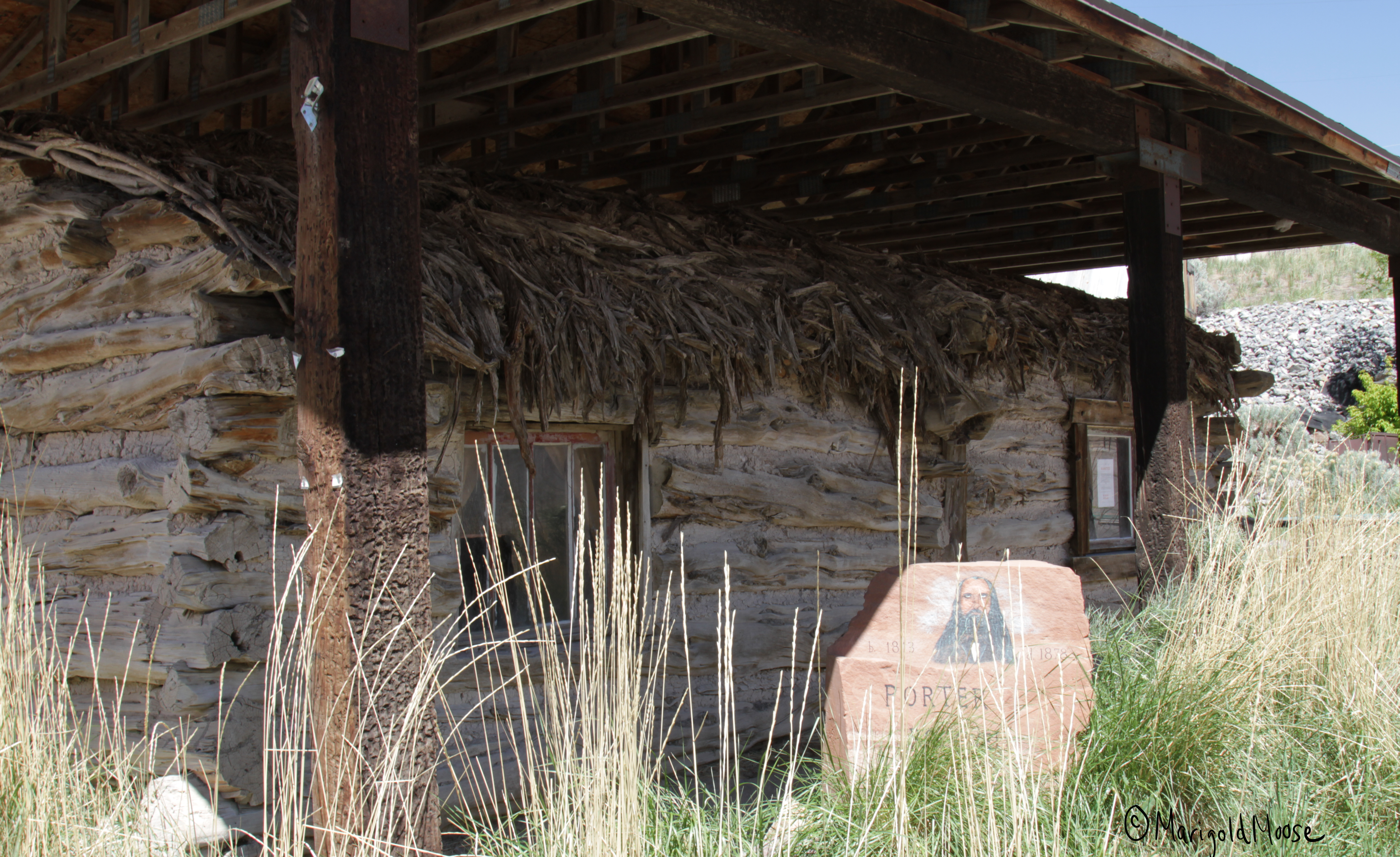
Porter Rockwell cabin in Eureka.

May 1 of this year the cabin’s back door was yanked open, there are signs around the downtown about a reward for information on it. I’m not sure how you could do that with this sign…the eyes really do seem to follow you.

porter-wm

I CAN SEE THROUGH YOUR SOUL.

The downtown main drag has some shops, a fire station, a post office, and a caboose. Yes, a caboose. And no Zamboni. I’m guessing they’re not really big hockey fans out here.
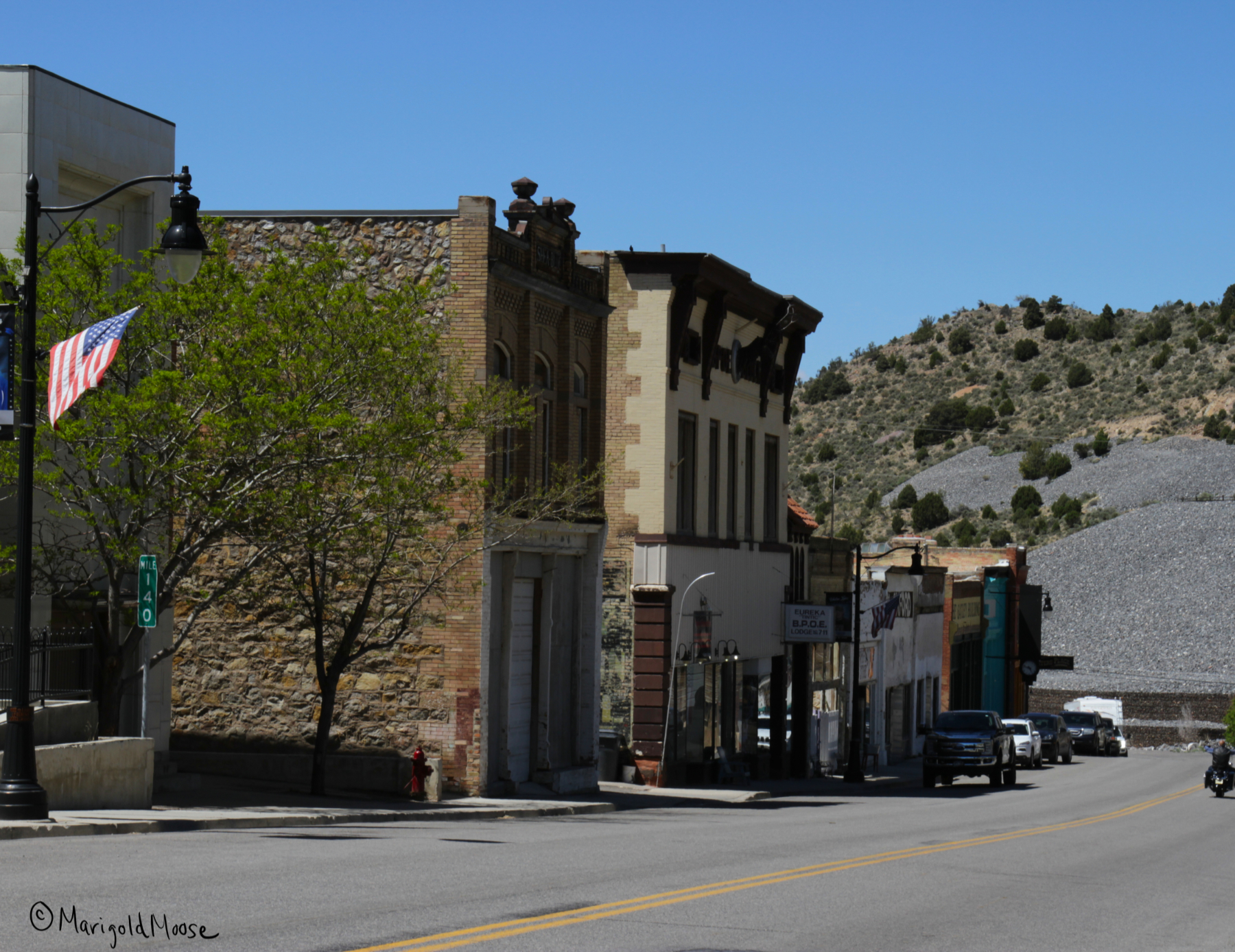
eureka-t-wm

Downtown Eureka.

caboose-wm-May-2020

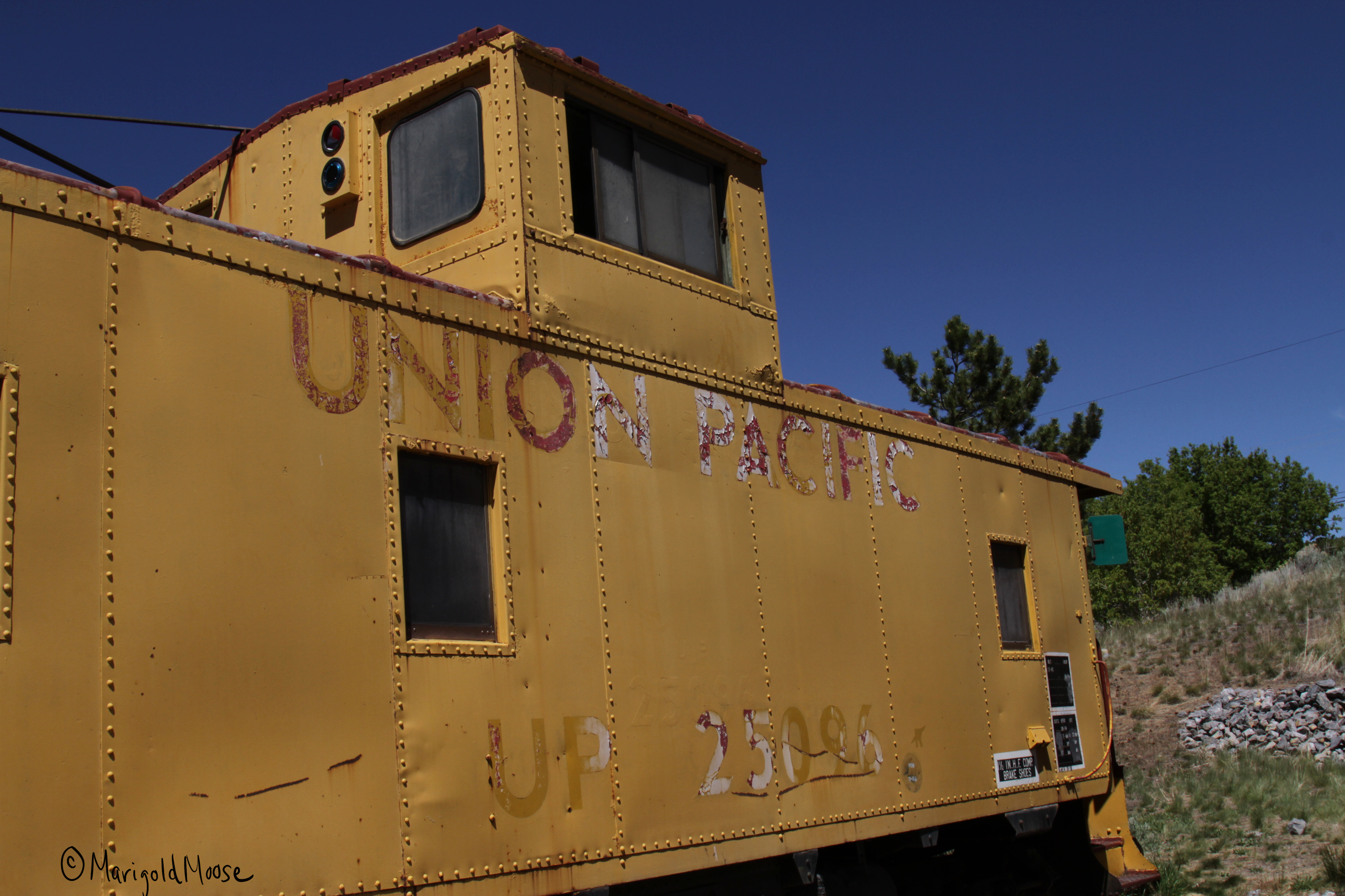
Caboose in downtown Eureka.

There’s also a little restaurant called Porter’s Place. We stopped in as they were advertising ice cream. BYU (Brigham Young University) ice cream to be exact. I had no idea this was a thing, but it was pretty tasty (we had strawberry!). The restaurant has some old timey details, the cash register still works, and the stairway by the bathrooms had some original brick that has been preserved. They also had a collection of old stoves and some penny candy (brought me back to apple orchard field trips, I am still 100% Midwestern). I also appreciated the Apocalypse Pies, but I think they were going for more Book of Revelations than Dean from Supernatural.

Main Street Eureka also has an interesting clock. I’m not sure how it works or why it has an elk (deer?). But again, the eyes follow you. I think it’s a theme in this town. Good thing it was clear and sunny out or I may feel a touch uneasy. Really though, Eureka is a cute little place and the locals are really nice and love to talk history. It’s a great stop when touring the West Desert.

Eureka-deer-wm-May-2020

I’m not sure on the how or why of this. Please draw your own conclusions.

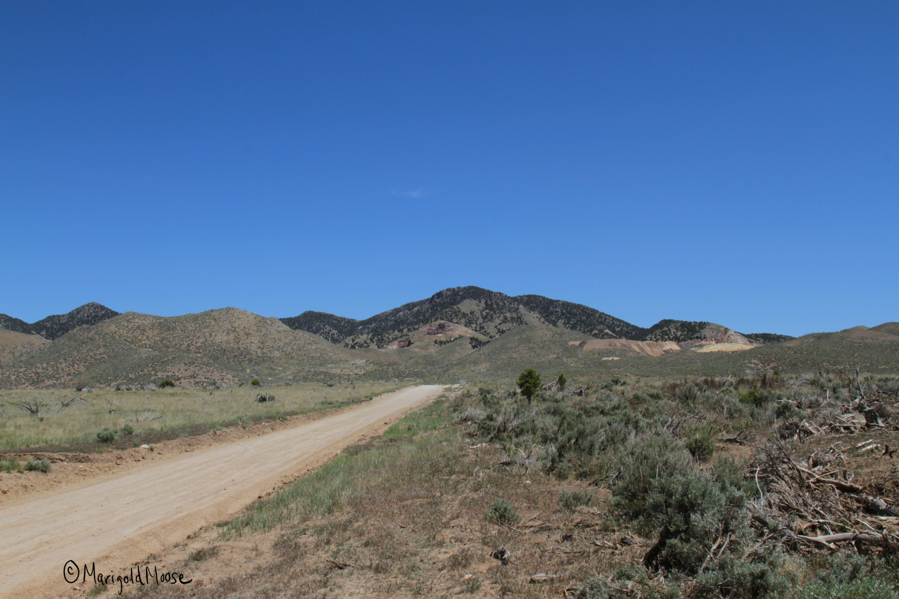
After Eureka, we headed to Silver City. This was a somewhat short-lived mining town in the Dragon Canyon area.

silver-ceme-wm

Silver City area near Ruby Hollow.

The local mines produced silver, gold, copper, lead, and bismuth. The town had about 800 people and several shops, saloons, and a post office. Two railroads ran out to the town as well. Unfortunately, the mines started to hit water in the late 1890s and mining declined. A fire hit the town in 1902. A smelter was built in 1907, which brought employment and the town grew to 1500 residents and a third railroad. By 1915 the smelter could not compete with larger operations in Salt Lake City and shut down.

silver-rd-wm

Silver City area looking toward Dragon Canyon.

Some people lived there through the 1940s, but today there is nothing left of the town, aside from a road sign for Silver City. Ruins of the smelter are found easily just after turning off US 6. We did not visit the smelter ruins on this trip, but we snowshoed them before and they are some foundations and mining equipment. There were also open mine shafts, so use caution.

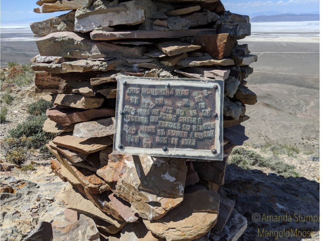
Continue down the same road the smelter is on and you will come to Silver City Cemetery, which is on the list of National Historic Places (as it’s really the only proof the town existed). The plot is very large, but not even half of it has been used (or maybe just is missing markers).

cem-silver-sign-wm

Silver City Cemetery, chained but not locked, presumably to keep grazing cows out.

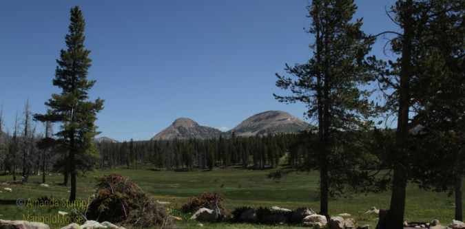
It is actually a beautiful area and was very peaceful. The area is spotted with small pine trees and small desert plants like sage.

silver-cem-wm

I was surprised by the number of somewhat elaborate (for the time) headstones which must have been expensive back in the late 1800s, as well as the fencing surrounding the plots for families. This metal fence had inlaid glass and was quite beautiful.

Silver-city-plot-wm

Many are for children, which shows how tough life was then, especially in the newly-developed West. The family with the metal-glass fencing had two sets of twins. I really love the names of these two little girls, Silvie and Goldy, showing the creativity of their parents and a nod to the mining business that provided for them. silvie-goldy-wm

After Silver City, we headed to the Fitch Cemetery before heading home. I didn’t take any pictures there. I kept reading how creepy the place is, but really it is just a family plot surrounded by a stone wall. It is also on the register of historic places and contains a Catholic altar for prayer. It is more recent (much more recent) than the Silver City Cemetery and fresh flowers and plants made it apparent it is not a pioneer cemetery. There is one stone that has tigers on it though, which was really the only thing of note. I guess it may be scary at night, and I saw a raven which may up the spook factor for some.

This trip took about half a day for us, coming from the Salt Lake City metro area. There are other places close that would make it a full day trip, and the Little Sahara Recreation area is nearby.

As far as animal spotting, we saw the hawks and osprey mentioned above on Highway 68 and some Pronghorns (American Antelope) in the same area. Other than that, mostly sheep and cows. We were very, very lucky to see a shopping cart in the wild, though. I had to be very quiet and use all my wildlife photography skills as not to spook him or get charged. This guy obviously escaped captivity and is living the free range life now.

IMG_0066

So majestic.


Solitude by the Weber River

Hopefully everyone is staying safe and well during the pandemic. Through the shut downs and quarantines, we were still allowed (and indeed encouraged) to get outside for exercise or a drive here in Utah. It’s not hard to be socially distant here if you take the back roads, avoid the popular canyons and parks, and generally just want to explore. A couple weekends ago we wanted to go poke around the Uinta Mountains (strangely the tallest east-west running mountain range in the lower 48 states). We (rightly) assumed the Kamas Mirror Lake road entrance would be crazy busy. So we went in the Evanston, Wyoming route.

weber-river-3-wm

We found a beautiful spot on the Weber River (we were back in Utah at this point). Still running high and cold from snow melt (and yes, that’s still mountain snow!) but so clear and beautiful. We are always looking for things we can see with small hikes or from back road driving. I know, I know. Ideally we would be hiking further, etc. BUT, I have a chronic illness (or two. Or three. It’s all speculation at this point) and sometimes I just can’t go far. Some days I can. This was a “high pain” day. But dammit, I’m still going to travel, explore, and see what I can! This was a mostly driving excursion with some sort hikes to break it up (and heated seats to help sore muscles after).

weber-river-wm

We only saw a handful of people, most were out jogging or poking around their yards. If you don’t mind a drive (and FYI the back rural roads in Wyoming have a 70mph speed limit!) and want some solitude, I highly recommend exploring the Wyoming entrance to the western Unitas.

weber-river-4-wmAlso found this old railroad bridge (Union Pacific!) that is now a back forest road. I was shocked it’s not been graffitied. That’s my Detroit side showing, I guess!

Stay safe and healthy, all. We’re all in this together. 💜