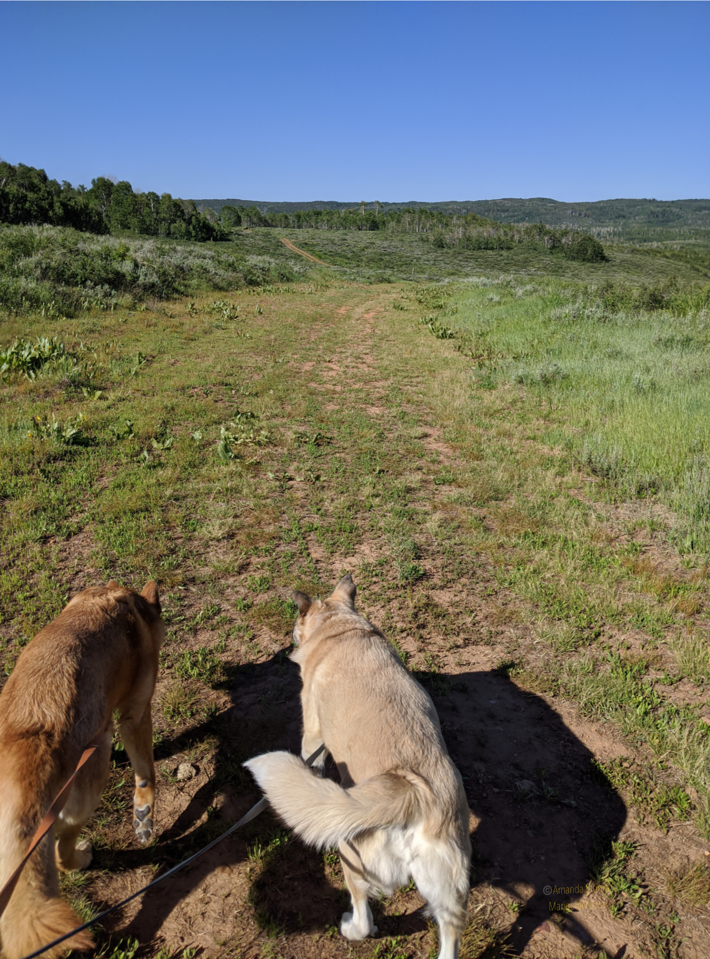
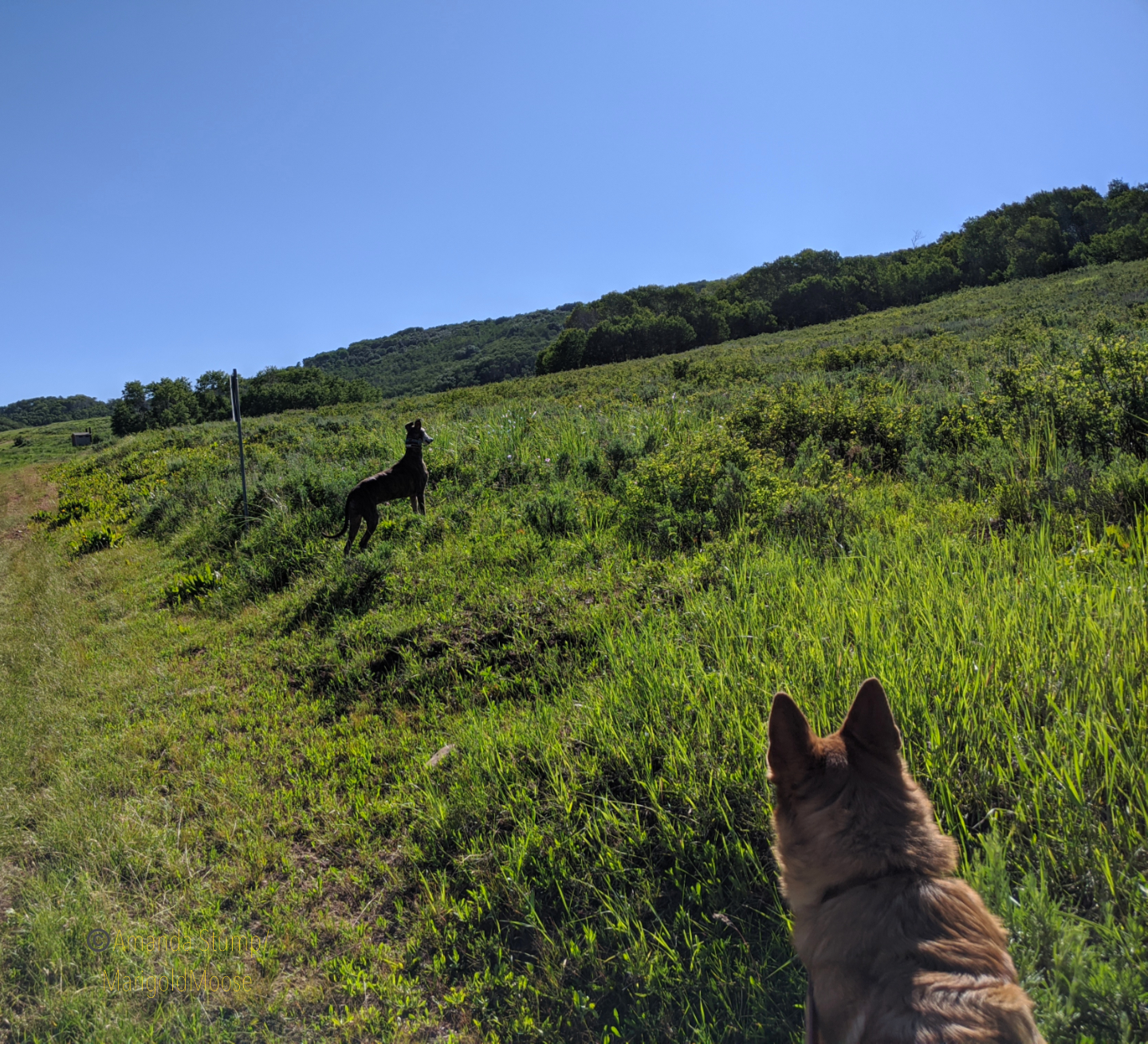
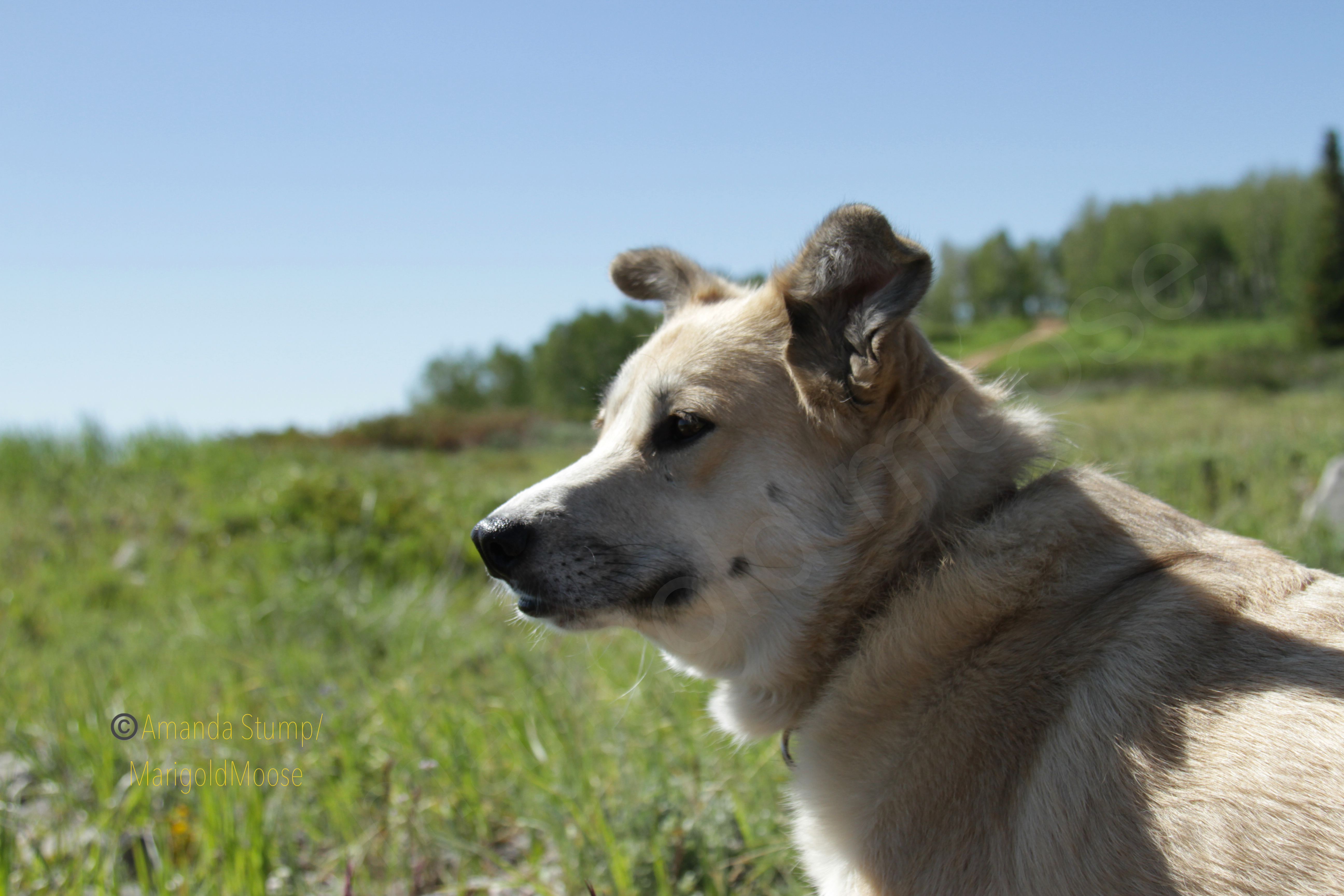
This past summer I took a little drive on my day off. Since I’m always in the Uinta Mountains (it seems), I decided to head up to the Wasatch Mountains this time. And I took all 4 dogs. Since Miss Moose isn’t up for big adventures, we did some short walks and a lot of poking around. I decided on Monte Cristo because I’m always up for food-named places and I heard it was beautiful. It’s northeast of Ogden and it’s usually a good 10-20 degrees colder than the valley. I headed up UT39 and took the dogs for a short run/walk on an ATV trail to get some energy out because enthusiasm levels were high, as you can see in the images below. Disclaimer: my dogs are leashed any time I intend to encounter another person. This was not that place, plus it was 7 am so you can see Reina is roaming.
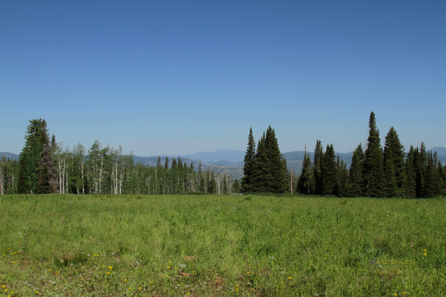
The views driving on UT39 are gorgeous. You can overlook the Ogden Valley and get some amazingly beautiful views. Not many pictures, though, as there aren’t a ton of places to stop and I was driving so no “ shoot out the window and hope it turns out” shots. I did find a nice pull off to experience the beautiful summer mountain flowers. I think those blue flowers below are a type of bellflower. Pretty meadows also give way to mountain landscapes. It’s definitely a great place for nature photography, if the valley inversions behave themselves. There was a bit of haze when I went out, but overall the view was pretty clear.
The girls had a lot of fun both poking around the hillsides and exploring. Dogs are welcome as it’s National Forest, just observe basic trail etiquette. Mt. McKinnon is the high point in the area, and again, the views are gorgeous. We ended up sitting on the side of the mountain for a little bit (Miss Moose mandated it) and just relaxing. We went on a weekday and it was fairly empty, though the campground fills up quickly in the summer.
We did a nice short morning excursion and we’re home in time to play with our foster kitten, Janika! (Gratuitous kitten picture below). Monte Cristo is absolutely gorgeous and only about 1-1.5 hours from downtown Salt Lake City, so perfect for a quick trip to get out of the heat or inversions. I haven’t attempted the route in winter yet, however and I believe part of the route on UT39 is actually closed once it snows.
The map below is pinned a little east beyond where I was on UT39. The National Forest is the green sector.
This will be part of a series on a week in Japan. We stuck to Kyoto and Nara only, and while we didn’t see everything (that would take months) we hit some popular attractions and some more out-of-the-way places. We went in mid-April, which happened to be cherry blossom season (believe it or not, we did not plan that!) We had a few plans of what we wanted to see, but mostly we found things by chance while wandering.
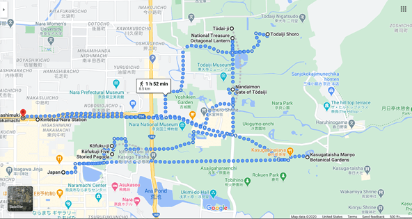
This post will cover the Tōdai-ji complex. There are interactive itinerary maps at the end of this post that cover the entire day (there’s a lot). Day 1 included the Tōdai-ji complex, the Kofuku-ji complex (the golden Buddha and a 5-story pagoda), the Katsugataisha botanical gardens, and the Katsuga-taisha Shinto Shrine. I’ll highlight a couple places we stopped and ate too!
(Click on any picture for a larger image).
Nara deer and sakura.
We actually stayed in Kyoto, in a traveler’s hotel right by the train station. It had breakfast included and an onsite spa bath (but not if you have tattoos). We were usually the only gaijin (foreigners in Japanese) there. Since we were still on US time and didn’t acclimate all that well, we ended up trying to visit the places we knew would be busy as soon as they opened (though some are open 24/7, even easier and fewer people). The first day (Sunday) we decided to visit Nara and the Great Buddha Hall (Daibutsu-den) at Tōdai-ji, as it is really popular and usually packed. From Kyoto to Nara takes about an hour by train.
The train ride to Nara (what I was awake for) was really pretty. Little farms all over and blooming cherry trees speckled throughout. Japan is an absolutely beautiful country.
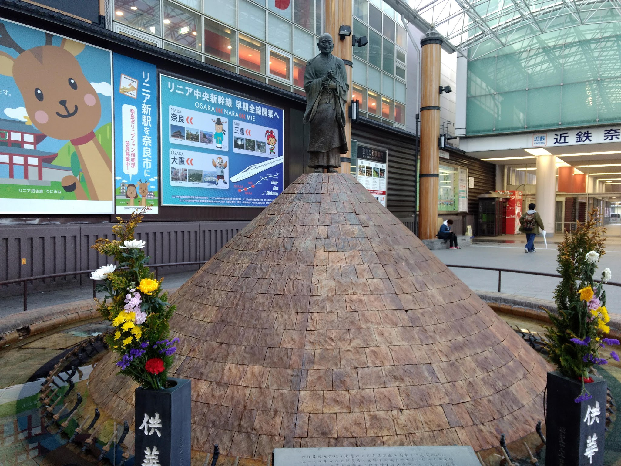
The lovely Kintetsu-Nara train station
Gyoki (a Buddhist priest of the Nara Period) outside the Nara trans station
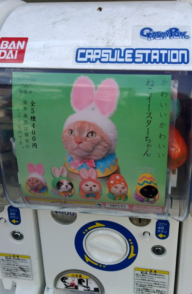
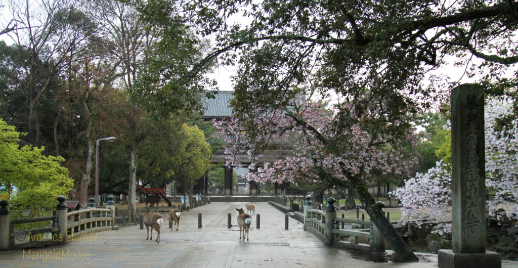
From the train station, we headed directly to Tōdai-ji (the Great Buddha Hall), as we knew it gets crowded quickly. We saw some very quirky and oh-so-Japanese things on the way, like the vending machine for cat hats and how a building was built around a tree (how all buildings should be built!) I also of course had to take a picture of a truck from my favorite delivery company, Yamato Transport (or kuroneko, meaning “black cat”).
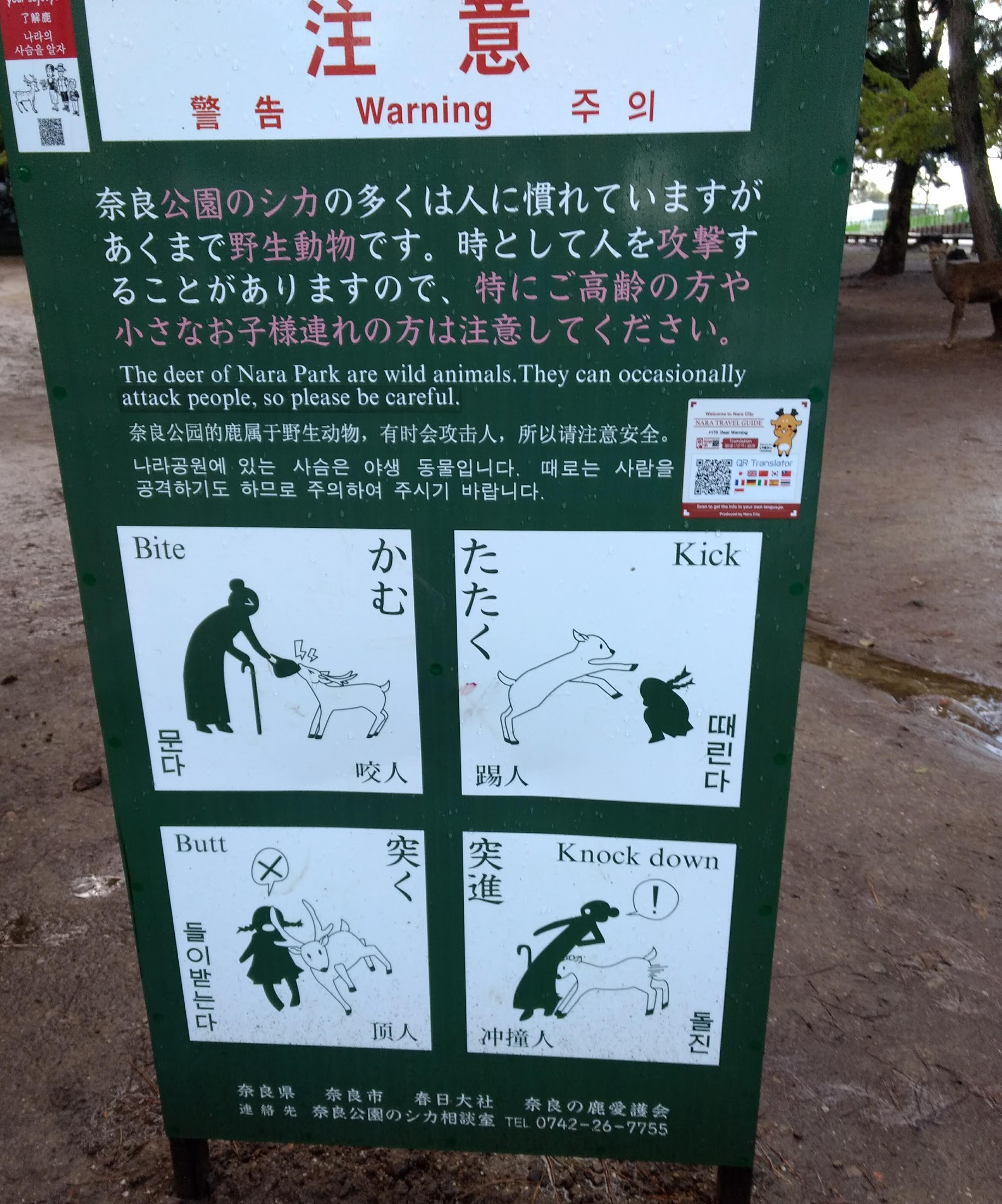
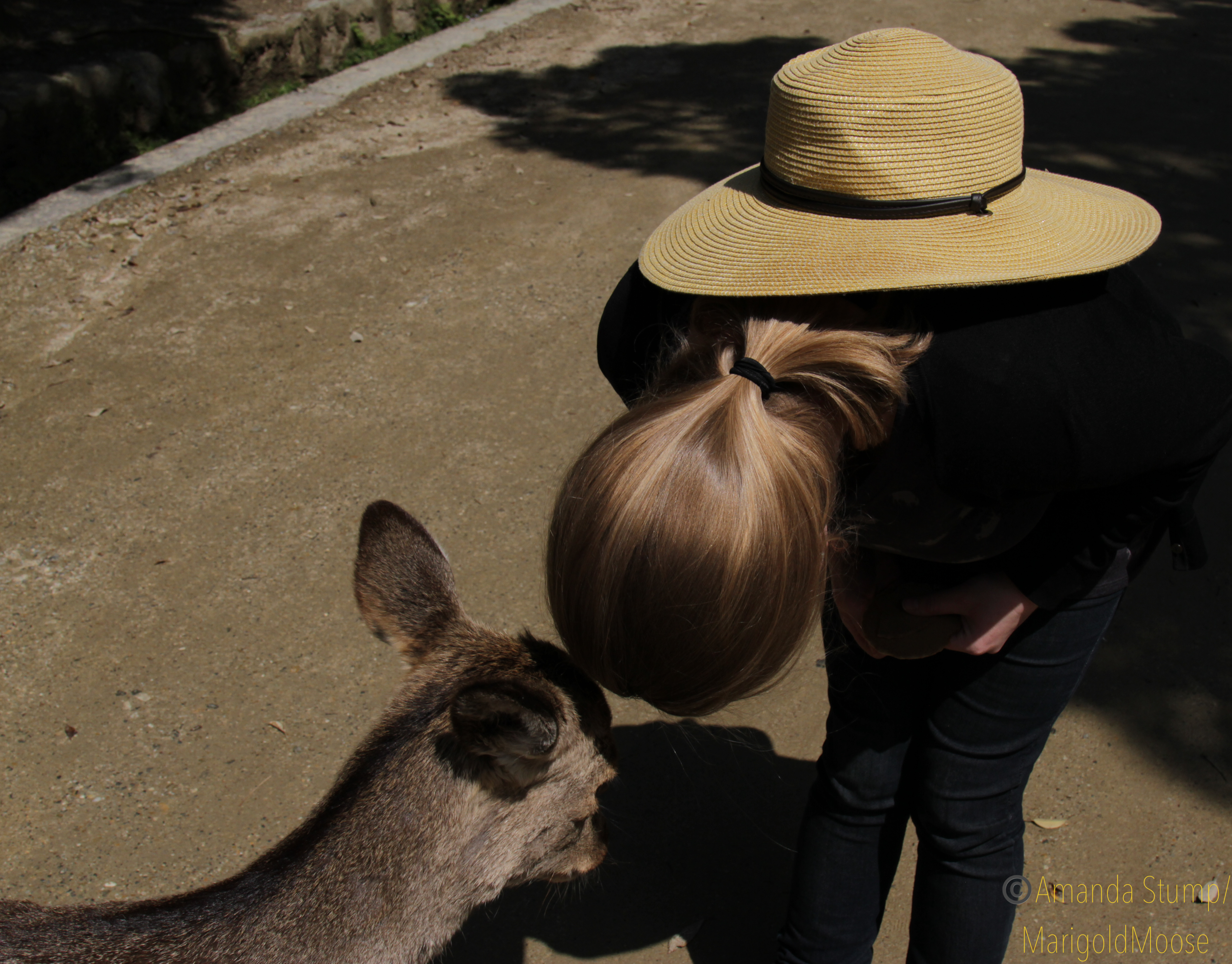
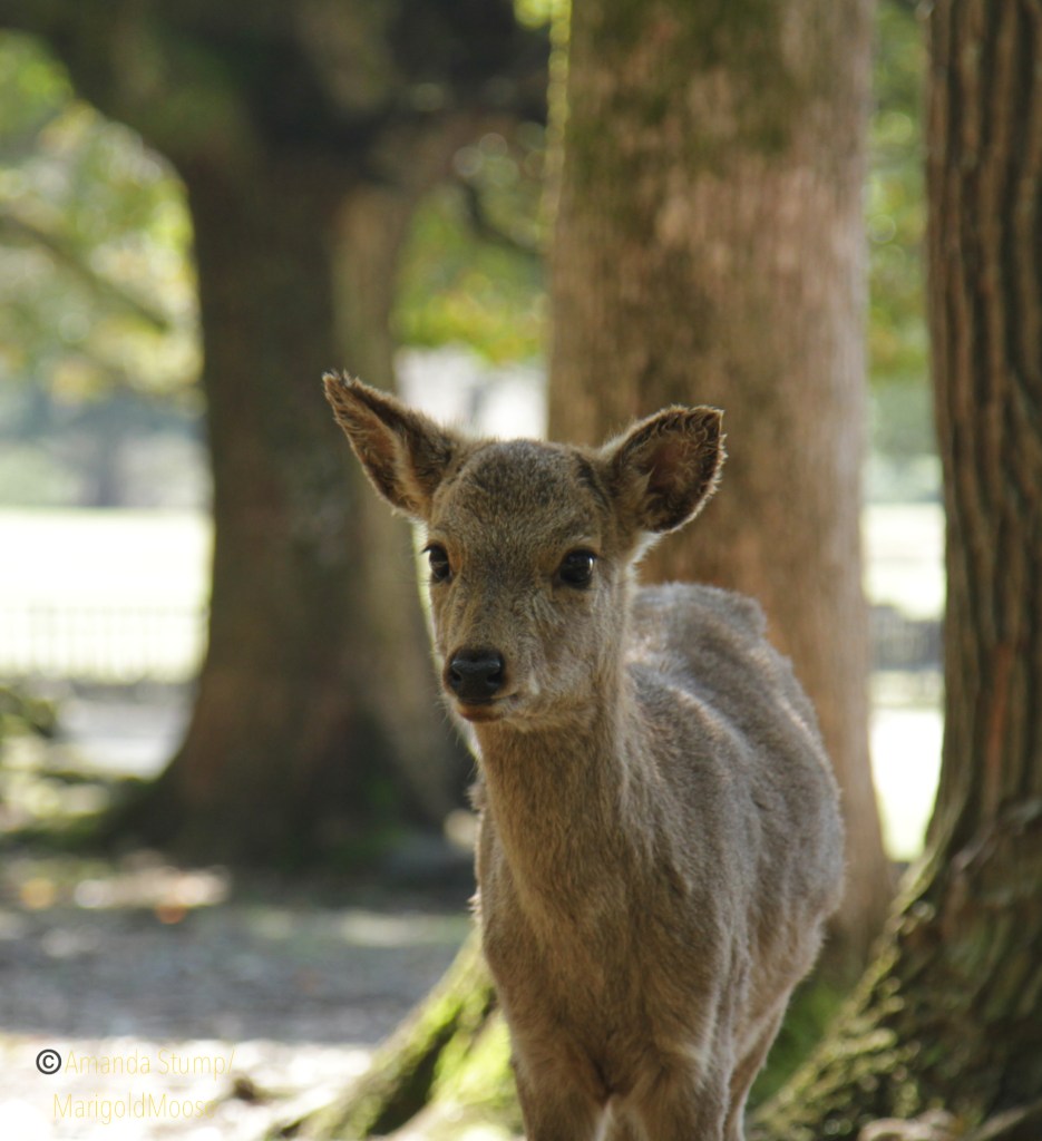
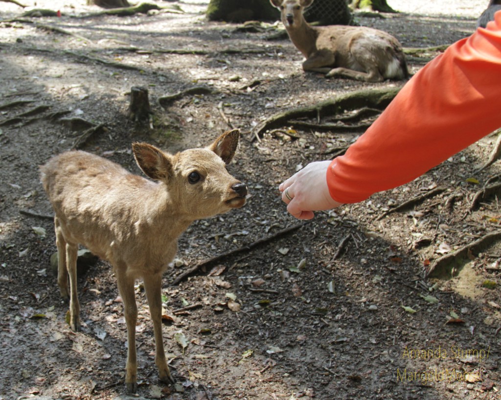
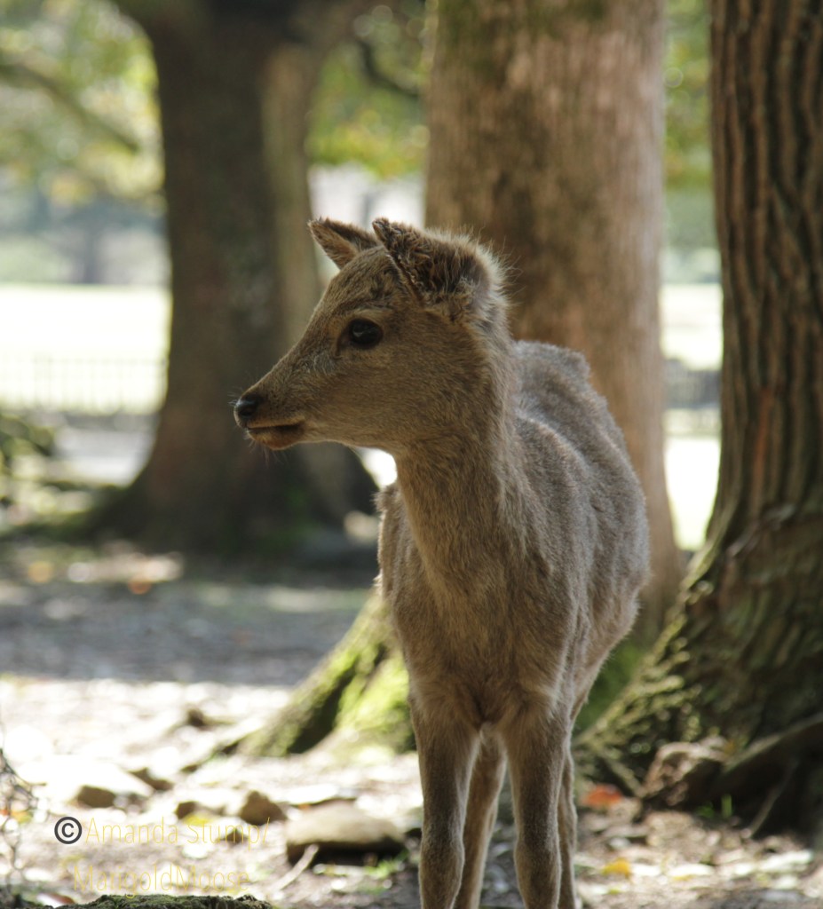
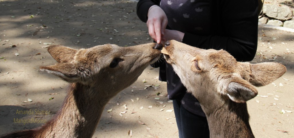
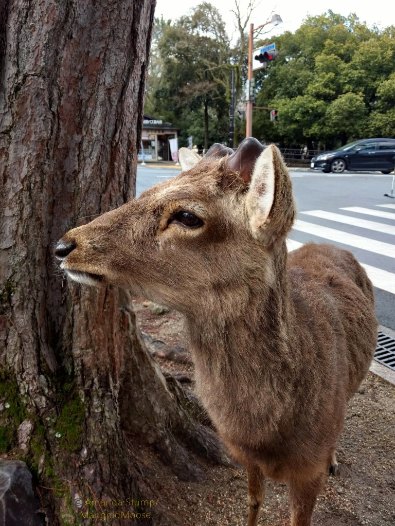
Nara deer, thought to be messengers of the gods, dot this area of Nara and are protected. They are beautiful, friendly, and will also assault you for cookies. Or knock you down?
I love this sign. So, so much.
Also, many will bow to you if you bow first (a deer biscuit helps). SO polite, and how often do you get to bow to a messenger of the gods?!
Bowing with a messenger of the gods.
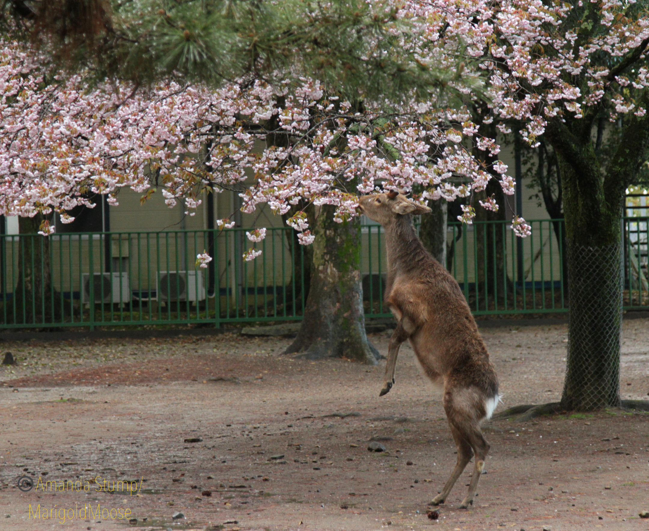
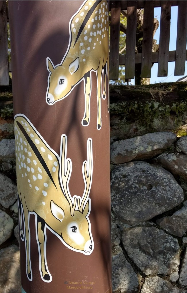
The deer are Sika deer (Cervus nippon) and are quite a bit smaller than white tails or mule deer (the US actually has Sika deer too). They are really everywhere around the deer park in Nara. You can feed them, but only deer crackers (which can be purchased from vendors inexpensively) as other foods can make them sick. They also seem to love eating cherry blossoms (sakura).
The Nara deer love those sweet, sweet sakura.
Nara deer!
Nara in general is very clean and pretty. They really do love their deer, and you can see their images on so many things around town.
The Tōdai-ji (temple) was (originally) built in the 700s and has the largest bronze Buddha in Japan. Before you get to Tōdai-ji, you will enter the temple complex through the Great South Gate (Nandai-mon Gate) of Tōdai-ji, which is, in itself, amazing. (I will have posts in the future that go through the history of these locations, stay tuned!) The gate was built in the 1200s, and contains two Nio, or temple guardian statues, carved out of wood.
Nandai-mon Gateand yes, more Nara deer.
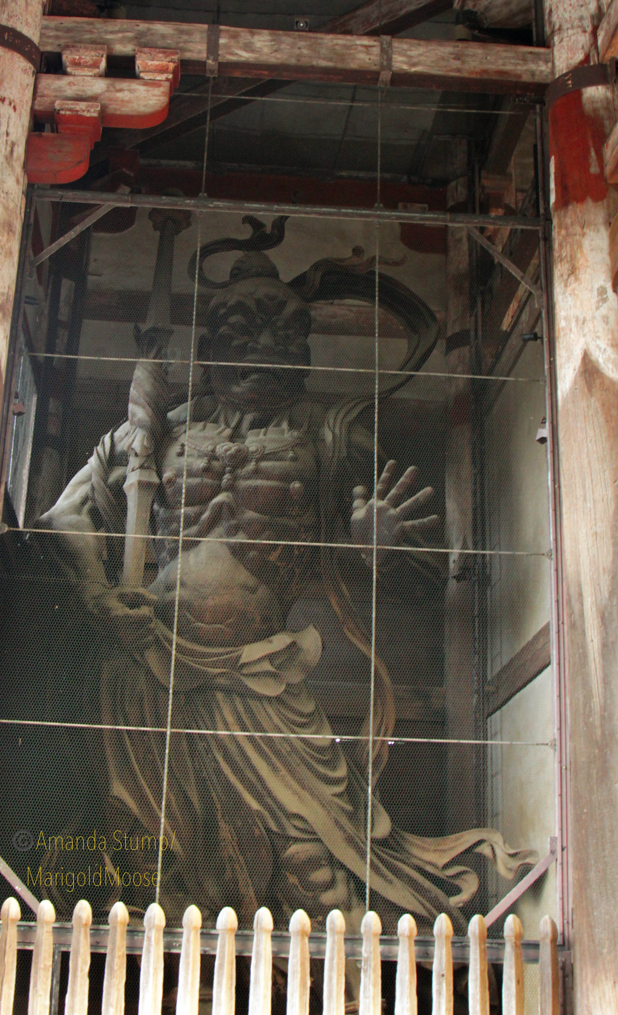
Nio are commonly found at Buddhist temples and guard the temple from evil spirits (they are guardian kings and found in pairs). It’s hard to get a scale of those at Tōdai-ji, but in the image below I am not even as tall as the white fence in front and I am 5’2″. So they are MASSIVE at about 28 feet tall (8.4 meters). And carved entirely from wood. It’s hard to get a good picture as they are behind glass for protection, but they are very impressive in person.
Nio at the Nandai-mon gate
We actually go to Tōdai-ji so early that it wasn’t open yet (it opens at 8:00am), but the temple grounds are open 24 hours a day so we strolled around. There is a lot to see at Tōdai-ji– you could spend hours without ever going into the Great Buddha Hall itself. Of note is the Tōdai-ji bell, which is surrounded by sakura trees and, seemingly like everything in this complex, is huge. The complex has beautiful architectural details everywhere too. It’s very quiet and peaceful, especially in the early morning. It was also a bit uncharacteristically cold for April when we were there, so that also kept the crowds down (good for us, cold is my friend!)
Tōdai-ji bell
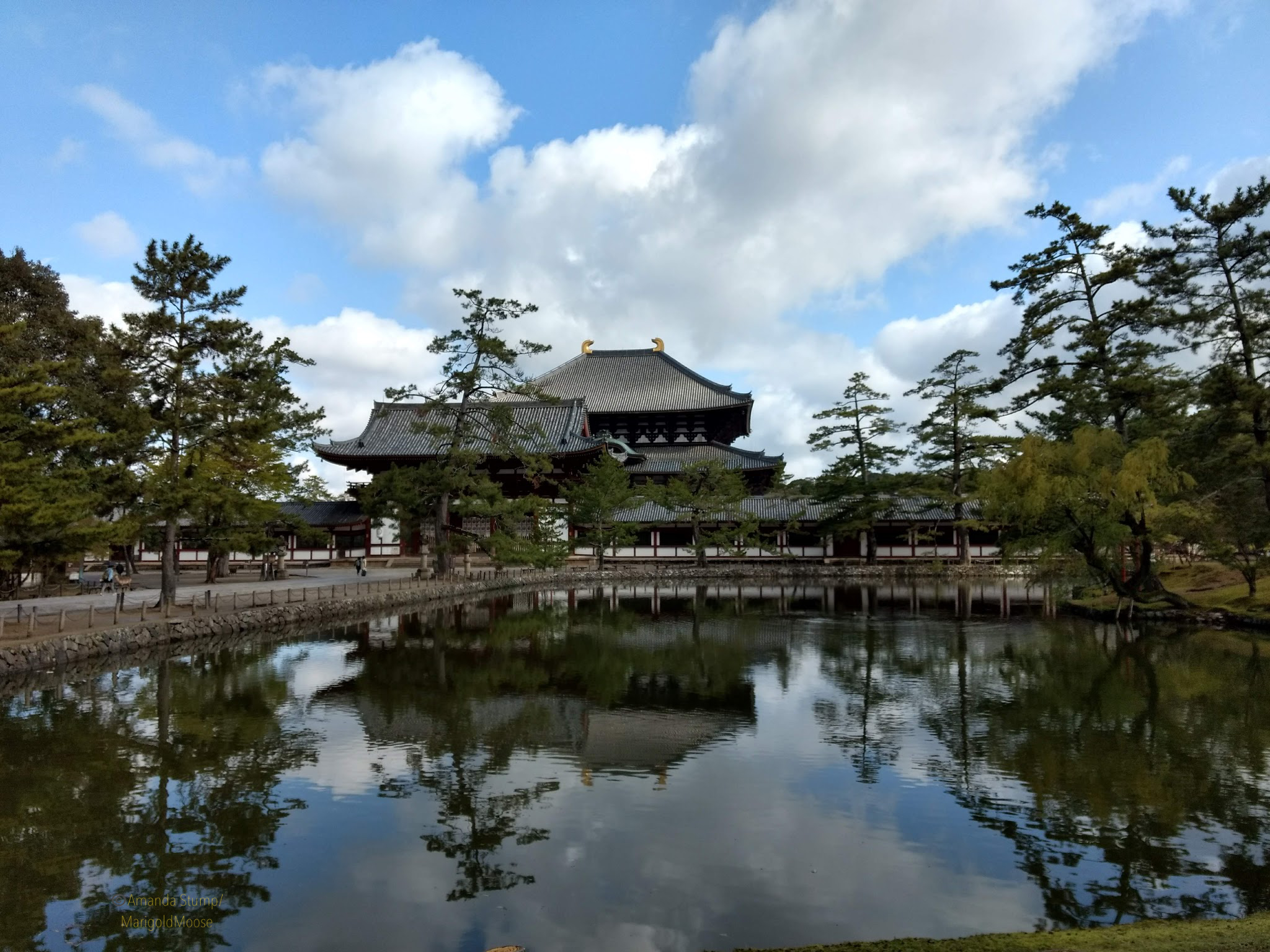
After wandering the grounds, we headed toward Daibutsu-den. There is a beautiful pond in front of it known as Kagamiike. Deer wander through the entire complex. I saw a couple ducks too, and there are koi in the pond.
Daibutsu-den and Kagamiike
Before entering the Daibutsu-den itself, there is an additional gate that denotes entry to the hall complex. The orange color commonly is associated with Shintoism, but this is definitely a Buddhist shrine. There are phoenix designs on the gate decorations as well, which is usually a sign of the imperial family (especially the Empress), but it can also mean grace.
Tōdai-ji Naka-mon
Another stop of note just outside Daibutsu-den is the octagonal lantern, which is a national treasure. It’s quite large (of course!) and really ornate and dates to the 8th century. (I have no idea why my picture is slanted, I blame the fact that it was early and Japanese coffee is much weaker than what I am used to).
The octagonal lantern at Daibutsu-den
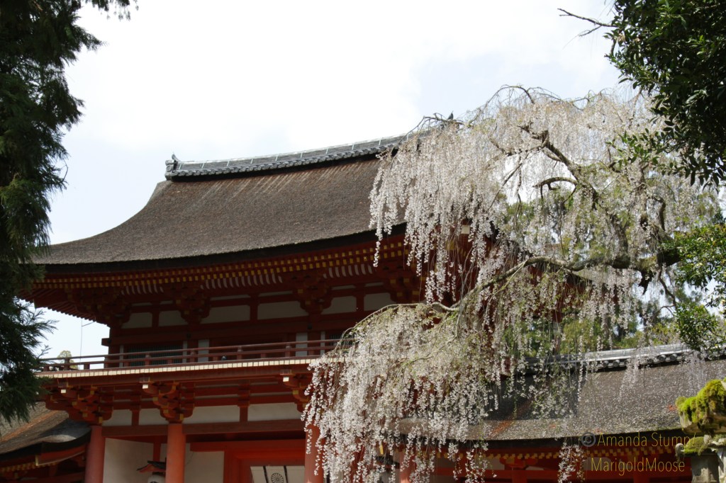
The Daibutsu-den itself is the largest wooden structure in the world (it burned on several occasions previously, and was once even larger than it is now). It’s hard to get a sense of scale, but it is immense. Everything is Japan is so precise, even the grounds were absolutely perfect.
Approaching Daibutsu-denDaibutsen-den grounds with beautiful weeping sakura.
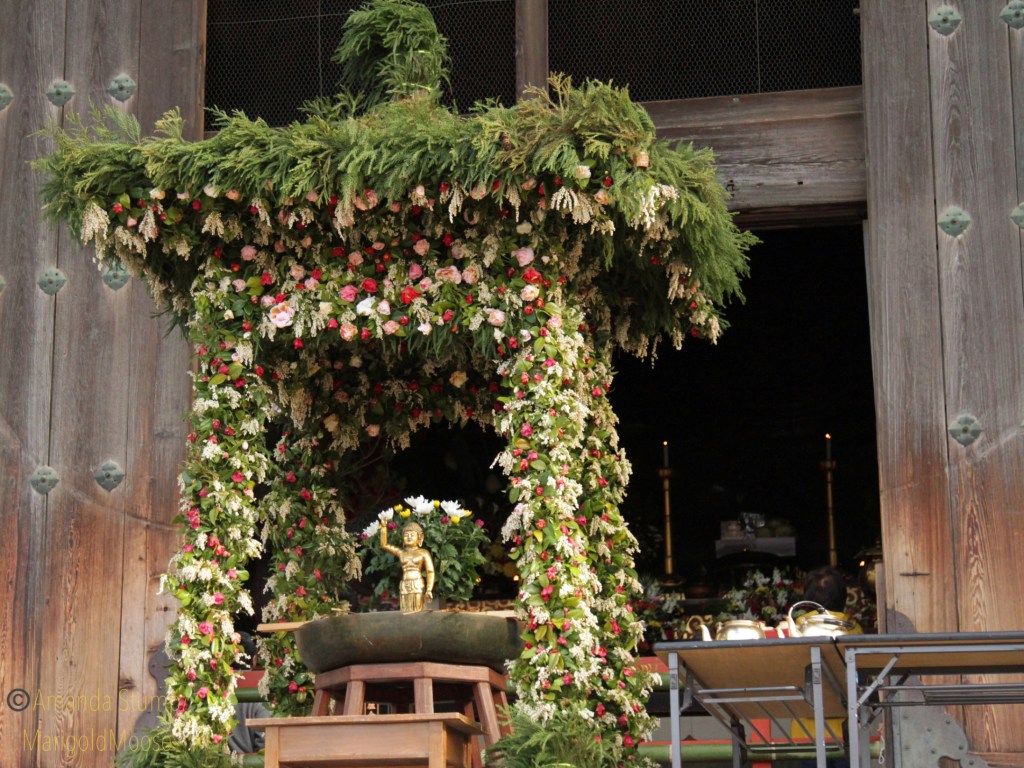
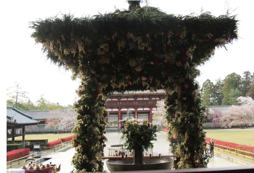
When we were at the temple, there was some sort of a meeting or event with a group visiting the shrine (from a Japanese company, I think). A beautiful and elaborate flower arch was set up as part of the celebration. This was on the main terrace, just outside one of the main doors. I think it was part of the altar decorations, but I need to look into it more.
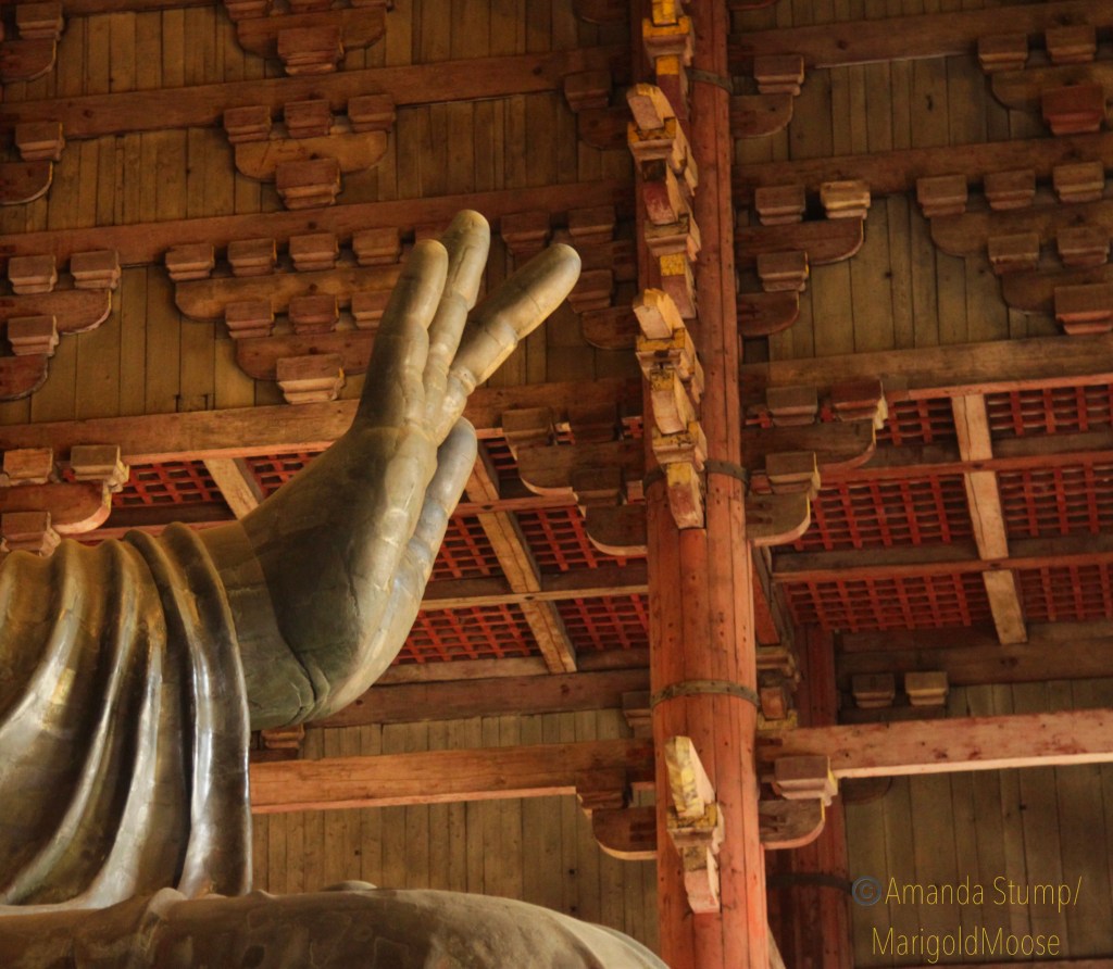
Once inside the Daibutsu-den, the giant bronze sculpture of Daibutsu is right at the front. From the image below, you can see the sense of scale. It’s much bigger than I imaged; the seated height is just under 50 feet tall (15.24 meters). This temple allows and encourages pictures, but not all temples in Japan do (the golden Buddha hall does not allow pictures, more on that in a minute). Respect that these are religious sites and follow the rules and respect those paying their respects. If someone was praying, I would wait for them to finish, bow to them (it always surprises Japanese when Americans bow politely!), and then snap my pictures after saying “sumimasen” (“pronounced soo-me-ma-sen,” excuse me in Japanese). Being kind goes a long way!
The largest bronze Buddha in the world.
Hand of Buddha from the side and the Daibutsu from through the main doors. The hand alone is about 8 feet high(2.4 meters).
The hall actually goes quite a ways back from the giant Buddha statue, and there is a scale model of the original (much bigger!) structure. The original hall was absolutely massive on a scale that is hard to comprehend. There are also two additional statues at each corner of the building, these aren’t exactly Nio but similar. They are temple guardians called Komokuten. Each is made fully of wood. I love their expressions (I think I have the same one…most days) and the carving is so intricate.
Interior wooden statues.
Another interesting item in the temple is a tall wooden pillar with a hole in it. This is known as “Buddha’s nostril” and is (supposedly) the same size as the nostril of the Bronze Buddha. Legend has it that if you crawl through the hole you will have good luck. I *might* have fit through, but I had visions of temple security guards having to extract me with grease or the jaws of life (honestly I wonder how many people get stuck) so I didn’t try it.
Buddha’s nostril. Seriously, how many people get stuck in this each year?!
To the right of the Bronze Buddha is a bodhisattva called Kokuzo Bosatsu, which is the bodhisattva of memory and wisdom. I study neurotrauma and memory issues, so I spent a little more time with this bodhisattva. This statue is (relatively) more recent and was built in the 1700s and has been (like the bronze Buddha) restored many times over the years. The candle soot tends to leave a coating on everything over the years that needs to be removed and the building and statues preserved.
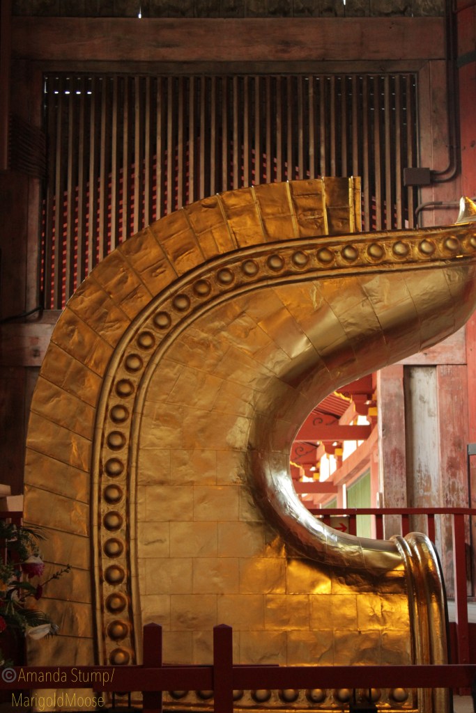
Speaking of replacement and refurbishment, at the front of the temple there is one of the finials from the roof that was removed. To give you more of a sense of scale, it’s probably over 20 feet tall and yes, that is gold leaf covering it. I am by no means tall, but I felt so tiny at this entire complex.
Removed roof finial and one attached to the roof. They. Are. Massive.
After leaving the Daibutsu-den, we headed nearby to the Kōfuku-ji, which is another Buddhist temple complex. Here is the Central Golden Hall, which contains a large golden Buddha (known as Chū-kondō) and a 5 story pagoda. Photographs are not allowed inside the Chū-kondō, and (as you can see below) I didn’t get great pictures of the pagoda (let’s blame the sun for this one, and not me being lazy and not adjusting mu camera settings). I did get an image of the outside of Chū-kondō though, and you can see it has the same style finials as the Daibutsu-den. The golden Buddha is also quite impressive, though not quite as large as the bronze Buddha.
Chū-kondō and the pagoda of Kōfuku-ji.
After Kōfuku-ji, we headed back toward the train station for some lunch. We stopped at a cute and tiny cafe by chance, called the Cafe Plum. The owner is so incredibly sweet, and the food was simple but amazing. There is an English language menu as well. I had coffee and green tea (not mixed, I’m not that weird) and we shared a sandwich and all was quite good. It is open for breakfast and lunch, and the location is on the map below. I’ll also link the TripAdvisor review here, as it’s not actually on Google maps.
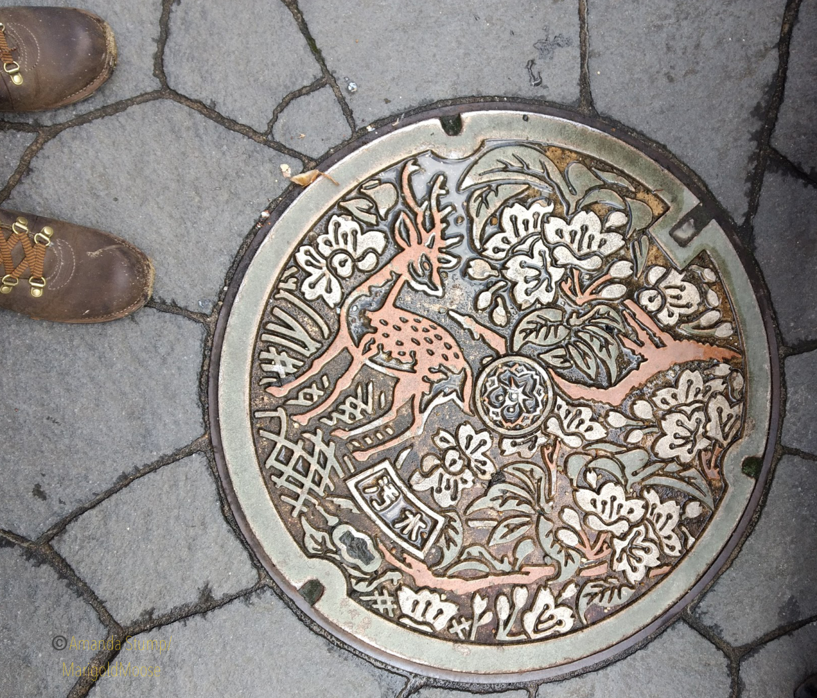
Heading out of the cafe I saw this beautiful manhole cover with the Nara deer and sakura (check out my favorite travel/hiking boots, too!). I guess there is a checklist you can use to find a bunch of these decorative covers throughout Japan, which I didn’t know until recently. I was just amazed so much care and thought was put into something like a manhole cover. Japan is truly beautiful. The second half of our Day 1 in Nara will follow soon!
The (interactive) maps for our itinerary are below. This was all done in one day with plenty of stops. Japan is very walking-intensive, but there are also plenty of places to rest and enjoy beautiful scenery.
Click on map image for the link to the interactive Google map!For second half from Botanical Gardens because Google only lets me pin so many places click above.
It’s so easy to socially distance yourself in Utah, especially if you’re heading out to the West Desert. We did a little day trip around Eureka on Memorial Day. I heard the parks here were absolute zoos this past weekend, but (as usual) the ghost towns were empty. I think we saw a handful of people in Eureka (not a ghost town) and that was it. LOTS of people and campers headed to Little Sahara and Great Basin, but none stopped where we did. We headed south down Highway 68, which is bordered by farm fields (we saw at least 30 hawks and ospreys out hunting) and Utah Lake. Before we turned west onto Highway 6, I stopped to grab a shot of an old Sinclair station in Elberta, a town named for a peach.
Sinclair Station in Elberta, Utah on Highway 6.
It’s obviously abandoned (there was an old gas pump there until about 2013 or so) but well-maintained and there’s even a picnic bench behind it. And it’s much more picturesque than the equally abandoned Amoco across the street.
Sorry, Amoco. You’re just not *quite* as cute as your Sinclair sister across the street.
Anyway, we started out by going to Dividend, which is home to the abandoned Tintic lead mine. Several years ago, before we moved out west, we explored the abandoned smelter and structures in the hills and were intending to go do that again. Well, (we did not know this until driving through) the mine and area has been on extreme lock down due to a very sad event in which two local teenagers were murdered and thrown in an abandoned mine shaft on the property (warning: the linked story is very disturbing). There is a nice (very large) memorial set up for the teens and most areas are now fenced off (and the mine shaft itself has been fenced). Some friends told us the property owner has security guards posted in the area, if you were thinking of ignoring the many posted “no trespassing” signs, FYI. The road through the area is still public and actually is a nice drive with some beautiful scenery, especially when you climb up the mountain. The event definitely puts a pall over the area, though. The only structure you can see easily from the road is part of an old bridge (below).
Tintic mine bridge ruins.
The area is also home to many sheep, and we saw a lot of lambs (they are really very cute, but as my husband reminds me they do not smell the best so I should not try to take one home). The sheep in the area are tagged with hearts, which is also very sweet. They were all freshly shorn and looked really well-cared for and happy. I mean, look at this sheep paradise!
There are actually many sheep in this picture! Looking west.
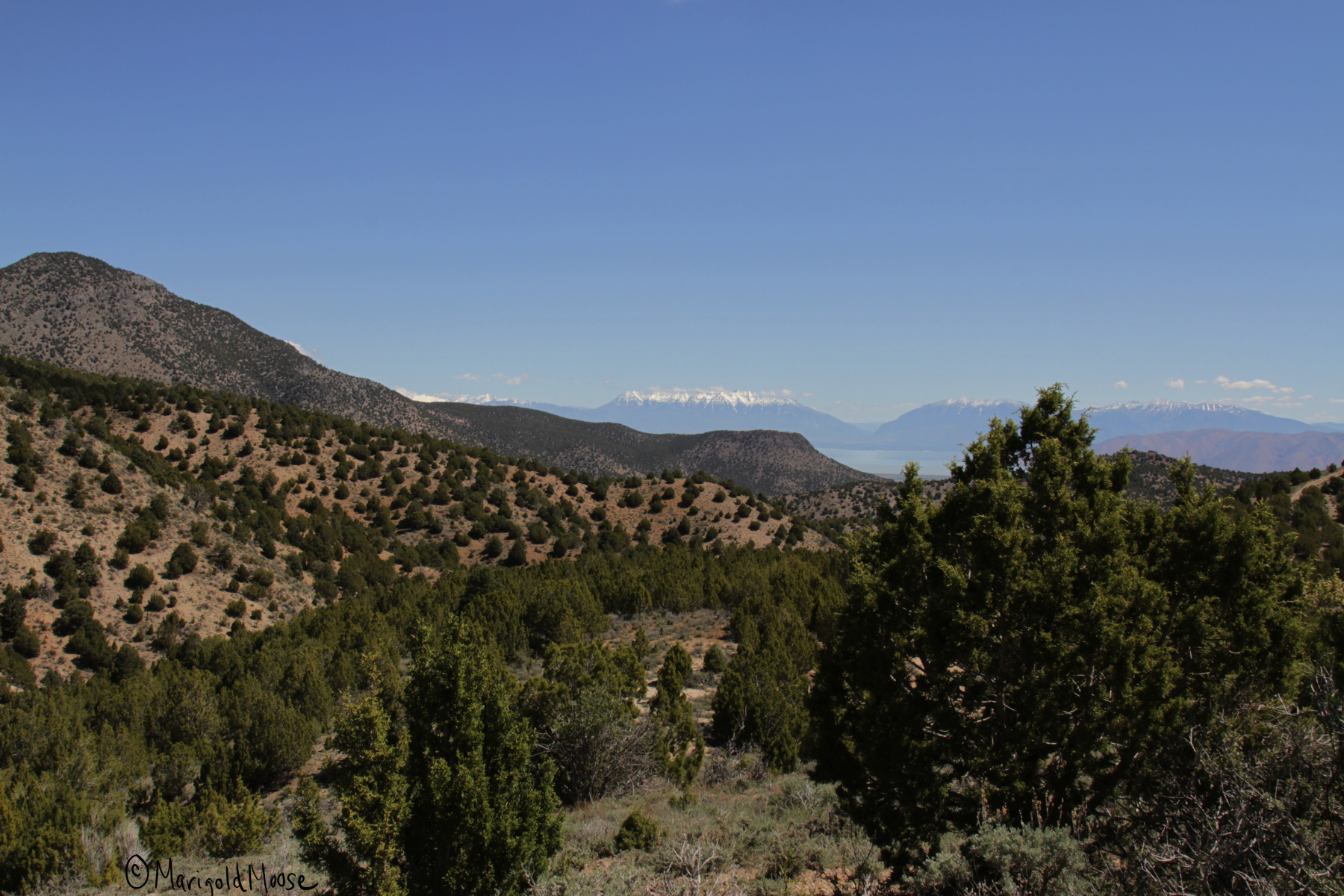
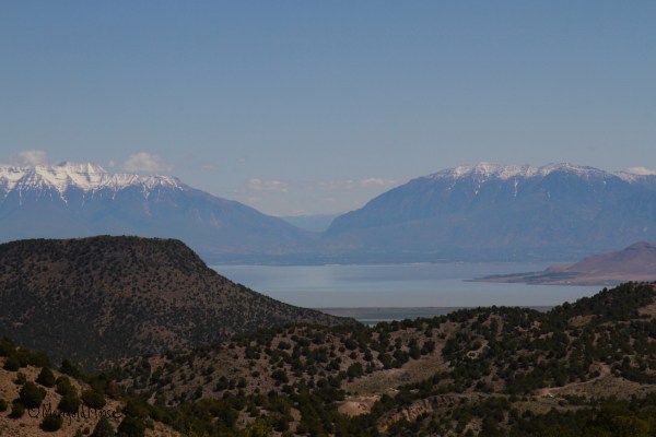
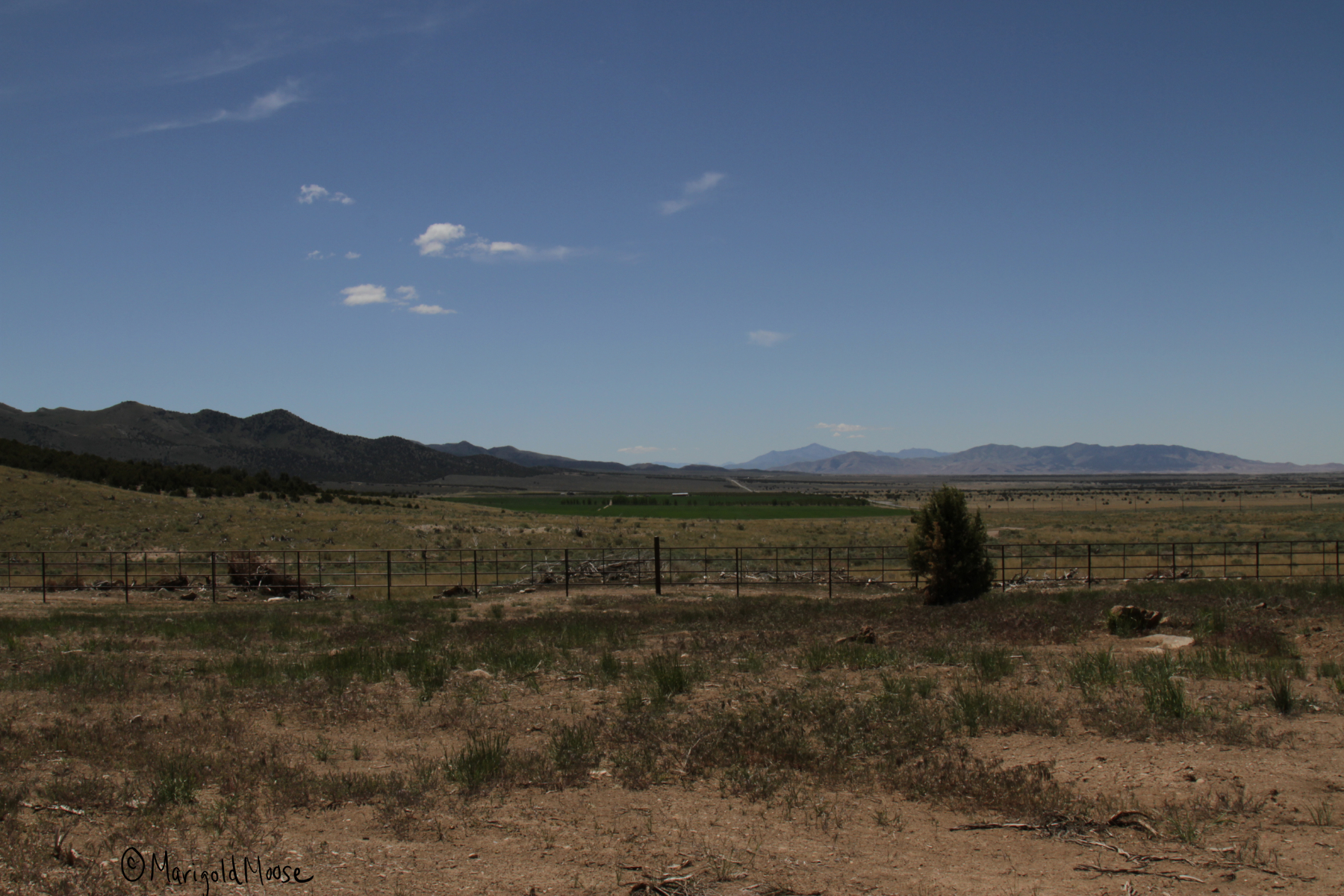
The area has some spectacular views of Lake Utah as well, it was a bit hazy when we went and I struggled with crystal clear pictures, so choose your days if you want better pictures than what I got.
Lake Utah and the Wasatch Mountains beyond the Utah Valley.
Lake Utah, which was actually much more green than captured here.
If you’re looking for mine ruins and want to skip the Dividend loop and the views above, continue on US 6 instead of turning off. The Dividend road will take you directly back to US 6 as well. Continue southwest on it and you will come to a little town called Eureka, home to about 800 people (and the hometown of the inventor of the Zamboni, Frank Zamboni). Sadly, there was no Zamboni that I saw or even a plaque. No wonder Utah doesn’t have an NHL team.
The remains of the Eagle and Bluebell mines are here, but are also clearly marked as no trespassing. There are actually a lot of structures you can see from outside, though.
Eagle Bluebell mine buildings in Eureka.
Abandoned equipment
Eagle Bluebell mine shaft
Mine office
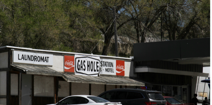
If you head back down to Main Street/US 6 there is a little downtown area that has been kept up pretty well. The Gas Hole gas station is definitely of note.
Please, please tell me they call gas stations this in Massachusetts.
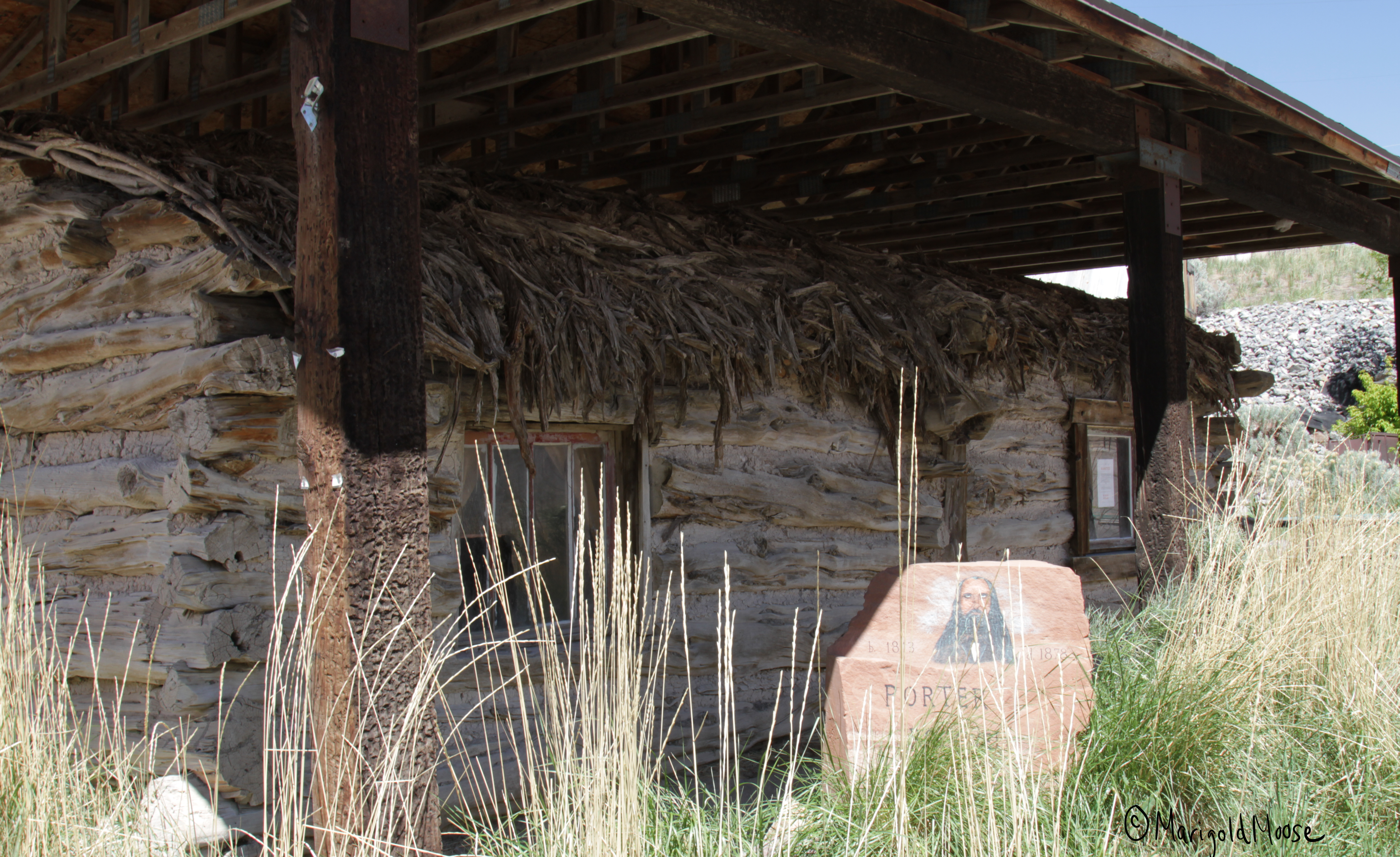
You can visit the Porter Rockwell cabin. Porter was called the “Destroying Angel” and was the bodyguard of Brigham Young (and is probably one of the more interesting historical Mormons, he even brought the first brewery to Utah, a fact we’re still celebrating). The cabin was moved from its original location of Cherry Creek to downtown Eureka to preserve it. It has an interesting thatched roof and one of the creepiest stone signs I have ever seen.
Porter Rockwell cabin in Eureka.
May 1 of this year the cabin’s back door was yanked open, there are signs around the downtown about a reward for information on it. I’m not sure how you could do that with this sign…the eyes really do seem to follow you.
I CAN SEE THROUGH YOUR SOUL.
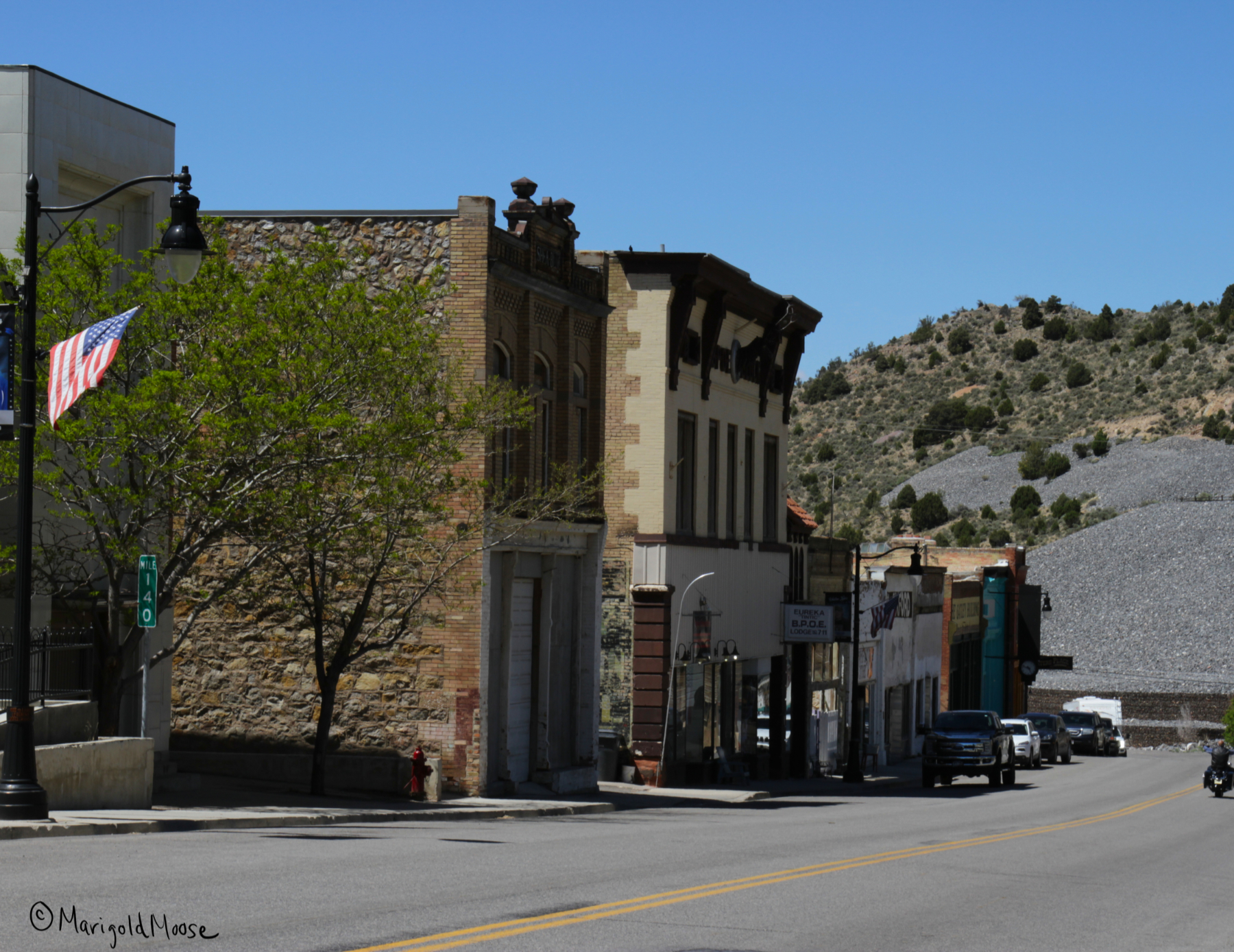
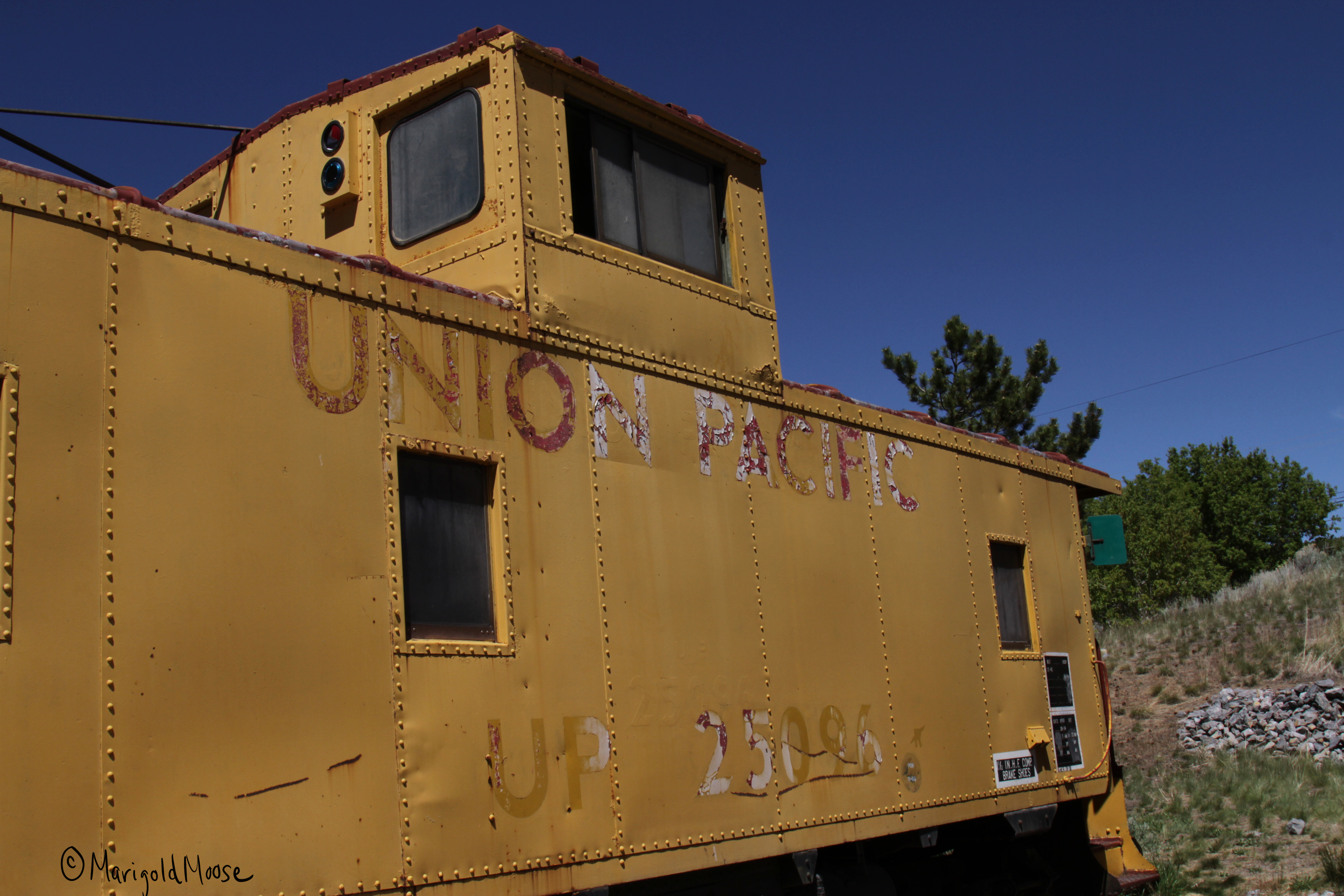
The downtown main drag has some shops, a fire station, a post office, and a caboose. Yes, a caboose. And no Zamboni. I’m guessing they’re not really big hockey fans out here.
Downtown Eureka.
Caboose in downtown Eureka.
There’s also a little restaurant called Porter’s Place. We stopped in as they were advertising ice cream. BYU (Brigham Young University) ice cream to be exact. I had no idea this was a thing, but it was pretty tasty (we had strawberry!). The restaurant has some old timey details, the cash register still works, and the stairway by the bathrooms had some original brick that has been preserved. They also had a collection of old stoves and some penny candy (brought me back to apple orchard field trips, I am still 100% Midwestern). I also appreciated the Apocalypse Pies, but I think they were going for more Book of Revelations than Dean from Supernatural.
Old timey cash register at Porter’s Place
Apocalypse Pies!
Old timey stairs.
Main Street Eureka also has an interesting clock. I’m not sure how it works or why it has an elk (deer?). But again, the eyes follow you. I think it’s a theme in this town. Good thing it was clear and sunny out or I may feel a touch uneasy. Really though, Eureka is a cute little place and the locals are really nice and love to talk history. It’s a great stop when touring the West Desert.
I’m not sure on the how or why of this. Please draw your own conclusions.
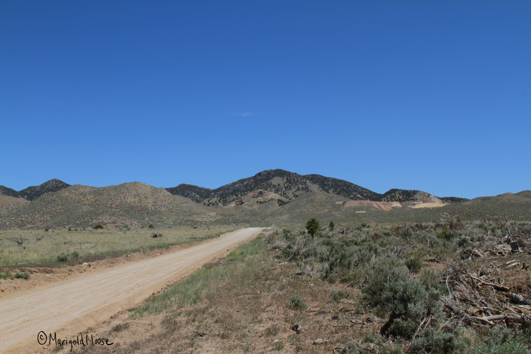
After Eureka, we headed to Silver City. This was a somewhat short-lived mining town in the Dragon Canyon area.
Silver City area near Ruby Hollow.
The local mines produced silver, gold, copper, lead, and bismuth. The town had about 800 people and several shops, saloons, and a post office. Two railroads ran out to the town as well. Unfortunately, the mines started to hit water in the late 1890s and mining declined. A fire hit the town in 1902. A smelter was built in 1907, which brought employment and the town grew to 1500 residents and a third railroad. By 1915 the smelter could not compete with larger operations in Salt Lake City and shut down.
Silver City area looking toward Dragon Canyon.
Some people lived there through the 1940s, but today there is nothing left of the town, aside from a road sign for Silver City. Ruins of the smelter are found easily just after turning off US 6. We did not visit the smelter ruins on this trip, but we snowshoed them before and they are some foundations and mining equipment. There were also open mine shafts, so use caution.
Continue down the same road the smelter is on and you will come to Silver City Cemetery, which is on the list of National Historic Places (as it’s really the only proof the town existed). The plot is very large, but not even half of it has been used (or maybe just is missing markers).
Silver City Cemetery, chained but not locked, presumably to keep grazing cows out.
It is actually a beautiful area and was very peaceful. The area is spotted with small pine trees and small desert plants like sage.
I was surprised by the number of somewhat elaborate (for the time) headstones which must have been expensive back in the late 1800s, as well as the fencing surrounding the plots for families. This metal fence had inlaid glass and was quite beautiful.
Many are for children, which shows how tough life was then, especially in the newly-developed West. The family with the metal-glass fencing had two sets of twins. I really love the names of these two little girls, Silvie and Goldy, showing the creativity of their parents and a nod to the mining business that provided for them.
After Silver City, we headed to the Fitch Cemetery before heading home. I didn’t take any pictures there. I kept reading how creepy the place is, but really it is just a family plot surrounded by a stone wall. It is also on the register of historic places and contains a Catholic altar for prayer. It is more recent (much more recent) than the Silver City Cemetery and fresh flowers and plants made it apparent it is not a pioneer cemetery. There is one stone that has tigers on it though, which was really the only thing of note. I guess it may be scary at night, and I saw a raven which may up the spook factor for some.
This trip took about half a day for us, coming from the Salt Lake City metro area. There are other places close that would make it a full day trip, and the Little Sahara Recreation area is nearby.
As far as animal spotting, we saw the hawks and osprey mentioned above on Highway 68 and some Pronghorns (American Antelope) in the same area. Other than that, mostly sheep and cows. We were very, very lucky to see a shopping cart in the wild, though. I had to be very quiet and use all my wildlife photography skills as not to spook him or get charged. This guy obviously escaped captivity and is living the free range life now.