
More snow
So let me start the story with the following; the hike was a 6.4 mile roundtrip with a 4200’ elevation gain, no I didn’t die, yes my legs almost fell off, and the recovery time was three days. Warning: all pictures were taken by my friend with a cell phone so they
We were planning a trip to Seattle to visit some friends of ours and the husband and I were planning a one day hike. Two days before we arrived, we were discussing options and he mentioned that he had two options; both were about a 6 mile round trip but one was a lot harder than the other. Naturally, I requested the harder of the two since I love a good death march. We were going to climb Mailbox Peak.
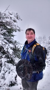
There’s a bit of background that’s important here. My friend Adam is in training to climb Mt Ranier this summer (He’s raising money for the National Park. Go here to donate and here to pick up a t-shirt or sticker) and is in fantastic shape. To quote Archer, “Someone get some duct tape, because this guy is ripped!” I should also add that I happen to be a tubby guy (round is a shape!) and I may have been suffering from delusions of grandeur. On the drive out for the hike he mentioned that he was excited that I’d chosen to climb Mailbox Peak since it’s considered the best hike to train for Mt. Rainer because of how steep it is. That should have been more foreboding than it was but all that occurred to me was that Mt. Rainier must be an easy 14000’ mountain to climb. We stopped at a grocery store for supplies (sunflower seeds and granola bars for me, Ramen for Adam) and then finished the drive to the parking area at the base of the trail. We shouldered our packs in the 41 degree rain (hey I did say it was the Pacific Northwest, right?) and headed up the trail.
Things started off easily enough. There was a constant but modest incline and a lovely stream that we were following. The buds on the vines and trees were just starting to open up and the waterproofing spray I’d applied to my jacket was doing its job. That was the first ten minutes. After that, the trail got narrower and steeper. The rain wasn’t too heavy so footing was good and the trail was well graded so the slope was constant. After 40 (hard) minutes of hiking, we took a quick break to eat a granola bar and check our progress on Adam’s trekking app. The report was 0.8 miles. The general consensus was that the app must be broken. As hard as we were working, there’s no way we’d only been averaging 1 mile per hour. More confident in our ability than our equipment, we continued.

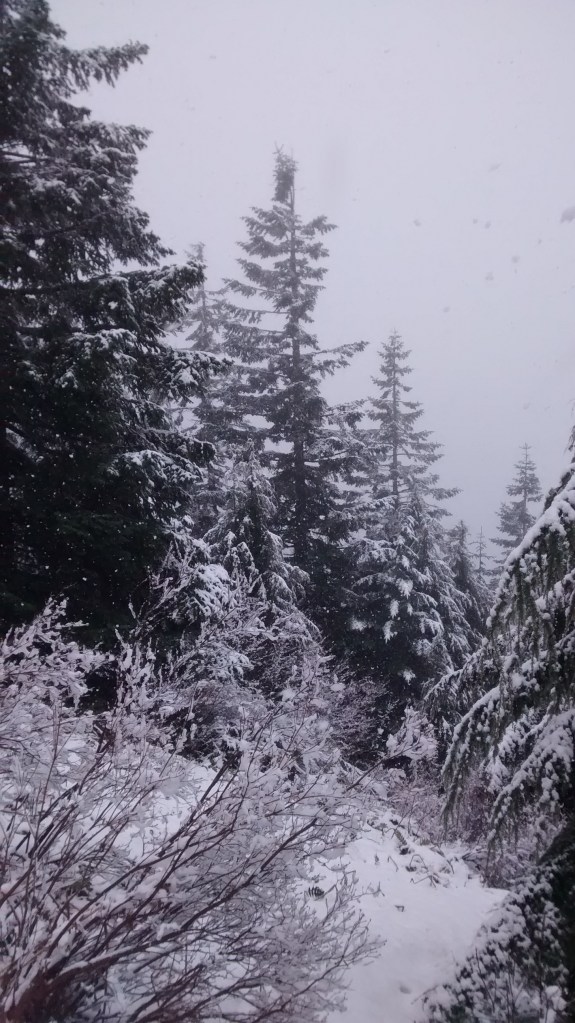
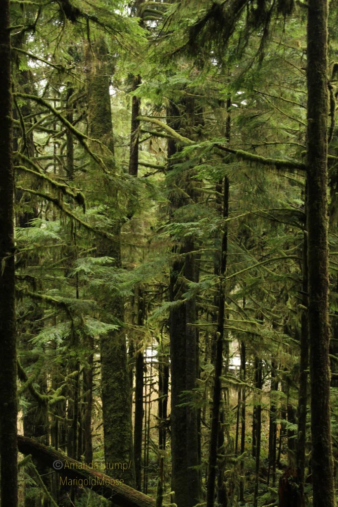
Such trees. Wow.
After that, the trail steepend. We kept running across places where erosion had created big steps where tree roots had stabilized the soil above but not below them. The bright side to these steps was that my quads started to burn from the frequent, irregular, two foot high steps instead of just my hamstrings burning from the slope. 20 minutes later it was time for another food and water stop. Another check of the app reported that we’d only covered another 0.4 miles. We *knew* that the app had to be misreporting things at that point.
It was at this point the hike started to get harder. Those tree steps became almost constant. The places between those tree root steps turned to soupy mud. How mud stayed attached to a 45 degree slope is beyond me. The trail also became less distinct. Fallen trees had trapped some of the mud from sliding down the hill and covered the trail. We meandered around a bit randomly (well the left and right were a bit random but we kept heading up) while looking for the white blazes that marked the trail. We’d site one and head over towards it. Sometimes we’d pick up the trail for a little while and sometimes we wouldn’t. The one constant is that we never went downhill, not even for one step. The trail just kept going up. There some sections that only had a slight upslope. When I hit them, it felt like I was floating it was such a relief.
After a while, I noticed that the blazes had little messages written on them. I only remember a few of them. About halfway up, one read “This is a no quit zone” and then about two blazes later, one read “The Flying Spaghetti Monster Believes in You!” With the Flying Spaghetti Monster on my side, I knew I could make it!

A note of encouragement?
Then it started to snow. The flakes were big, fluffy, wet, and numerous. And they were sticking. As we climbed, the snow started to blanket everything off the ground in a lovely layer of white and we started to encounter patches of packed snow/ice on the trail. We saw some smart hikers going up and down who had thought to bring yak-tracks so they could actually walk up the slick surface rather than flailing wildly and clawing your way up the slope. My jealousy knew no bounds.

…and so it begins.

Rain, sleet, snow…
Luckily (sort of) after 15 minutes or so of struggle, the falling snow got deep enough that the icy layer stopped being a problem since we were slogging through 6 inches of snow instead. When there would be a break in the trees, we were able to confirm that the wind was howling and there wouldn’t be a view from the top.
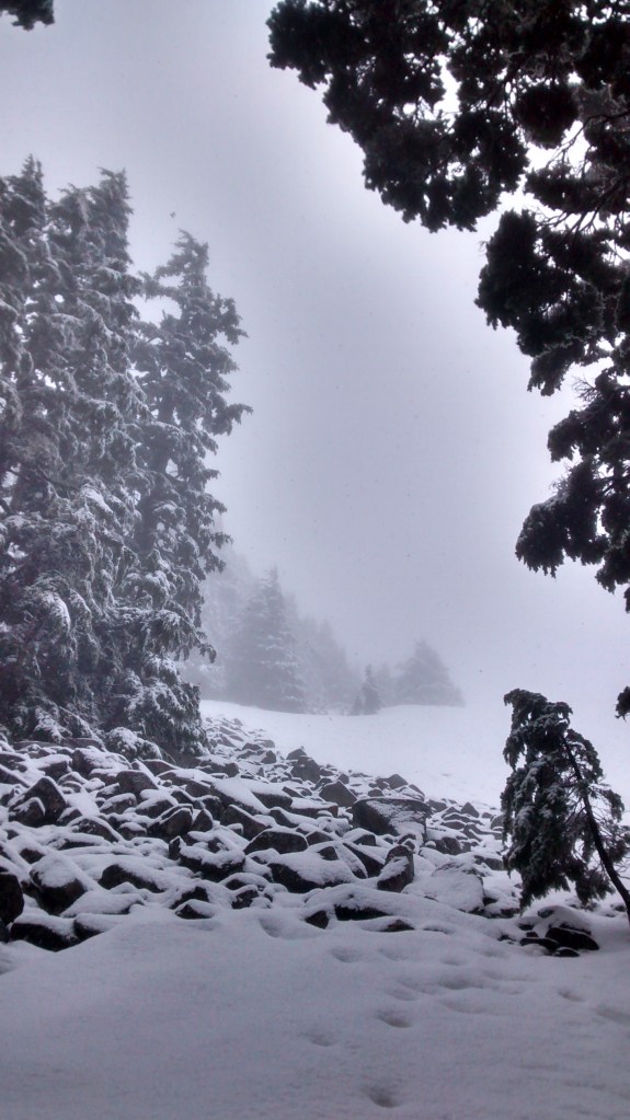
Best view we’re going to get…
The trail continued relentlessly until a big change finally happened. We came out of the trees and into the boulder field that was mentioned on the hike review I’d read before we left the house. That meant that we were near the top (good) but that we were also leaving the shelter of the trees and stepping out into that wind (bad).
Lovely.

And it thickens!
Up the boulders we went. The combination of snow and wind prevented us from seeing much the trail so we couldn’t judge how far we were from the top but we were constantly sure that we were almost there. The snow was so heavy that I has to frequently clean my hat off because of the build up.
It’s how much further?
A few hardy souls passed on the way down but there didn’t seem to be anyone behind us (at least no one else who was in good shape and moving fast). We even saw a couple of pooches heading down. The first couple looked relieved to be heading how but there was one hardy dog who looked ready for more.
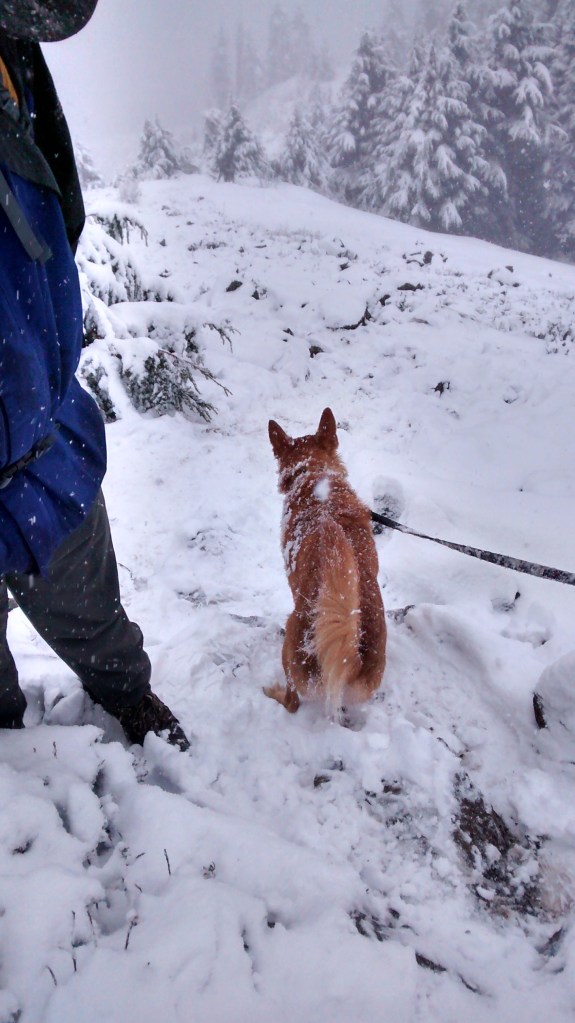
Cute little guy!
Finally, after 3.5 hours of struggle, we sighted the peak and headed up to the top. The snow was up to knee deep in places and it was clear that winter hadn’t left the mountain yet.
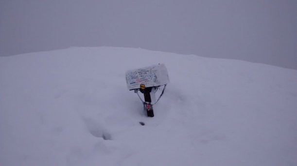
The summit mailbox
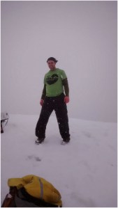
Summit
Adam added our names to the record book (I was too tired to write) and we turned and headed down the mountain again. I know that most of the time heading back down a hill is way easier than faster than climbing it but in the case, I think it was harder for me going down than going up. I tried to always keep my knees bent to avoid the impact of descending on my knees and my legs were quickly protesting. On top of that, without the work of climbing, the wind quickly numbed my hands and ears so I stumbled as quickly as I could to get back down to the tree line and out of the wind. That took about 30 minutes….
The trees shielded us but it took a long time to warm up as we slipped and slid back down the snow-covered slopes. I kept having to grab onto the ice covered tree trunks and prop myself up on the snow covered ground. Those are really cold when you don’t have gloves!
It kept warming up as we descended and the air got noticeably thicker and dropped below the snow line after a little while. We found a spot next to the trail that was sheltered from the still falling snow and Adam whipped up a batch of Ramen while I munched on sunflower seeds. It felt good to hold that cup of near boiling water in my hands and I finally warmed up a bit. Adam dumped the water he’d been carrying as ballast (he’s serious about training for his Mt. Rainier climb) and we resumed our hike. We left the snow behind and went back to enjoying the rain and the mud.
After a while (maybe 45 minutes) we were passed by someone heading up the mountain even less prepared for the weather than I was. It was an Asian girl shorting calf a light jacket, calf length yoga pants, and mesh running shoes with no socks. I shook my head and mentally wished her good luck and kept trudging.
By now I was really hurting. The muscles/tendons connecting my knee caps to my shins were on fire. Stopping to rest didn’t really help since they would start twitching and I would almost fall over. I was able to walk but it HURT! I kept my legs moving as best I could and we kept going. Eventually those muscles went numb (which was an improvement sort of) and mostly stopped responding to my requests. My legs just kind of flopped around and gravity pulled my feet down the hill but at least I was able to keep walking. I told Adam that if my legs fell off he was welcome to roll me the rest of the way down the hill.
It was about that time that we started to hear a stream. That meant we were starting to get close to the bottom. To celebrate, we stopped for some water and a granola bar. That was when the unthinkable happened. The girl who I was worried would get frostbite an hour before came into view above us. She wasn’t just walking faster than us, she was running; actually running down the trail. We watched as she came down the switchbacks above us, passed us, and continued down the trail, around the switch backs, and disappear out of sight. I can’t remember the last time I felt so unmanly. Adam consoled me by telling me she probably hadn’t gone to the top (and considering her outfit he was probably right) but it wasn’t especially helpful at the time.
We resumed our march as the stream got louder and louder until we could see it again. It came into view as a lovely little waterfall and was a sign that we were down to 30 minutes of hiking. The trail started to level out a bit and the going started to get easier.
The rest of the hike was pretty boring so I’ll spare you the details. We made our way back to the car and headed back to Adam’s out. The wife and I made bacon, prosciutto pizza for the group and I introduced Adam (a big peanut butter fan) to the joys of cookie butter. The next day we went to the REI flagship store and I got lots of confused looks as I staggered up and down the stairs like a 100 years old man. Once I explained that I had climbed Mailbox Peak the day before, a wave of understanding washed over the faces of all of the people I talked to.
Anyway, the hike was fantastic and I highly recommend it if you’re into death marches especially when you can see the view from the top (I’m told it’s nice). I might even climb it again the next time I’m in Seattle. Don’t forget to support Mt. Rainier and the National Park and grab a t-shirt or some stickers by going here!


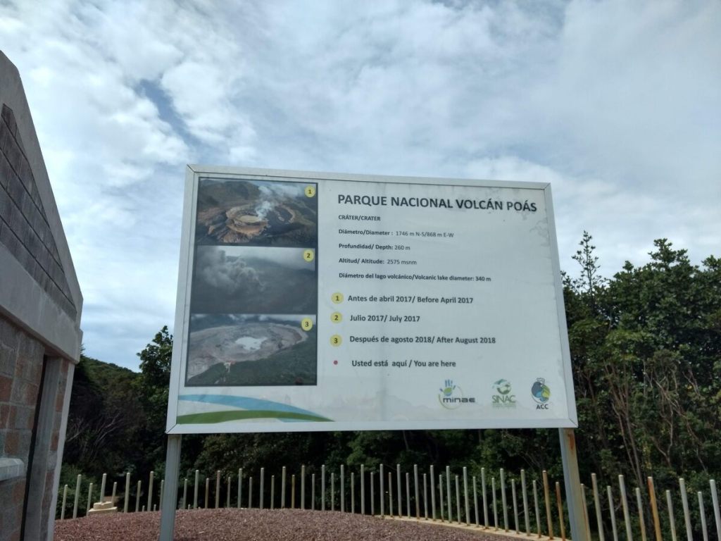


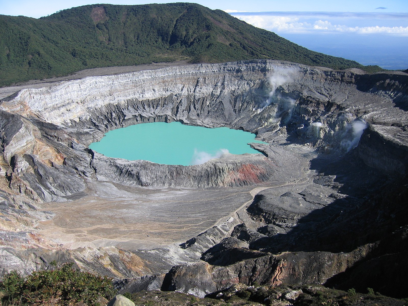


 Saw this little guy near the Poas Volcano in Costa Rica. I believe it’s a wasp, but I’m not sure on the species. I can ID animals well, but not always insects. If anyone knows please fill me in! 💜


